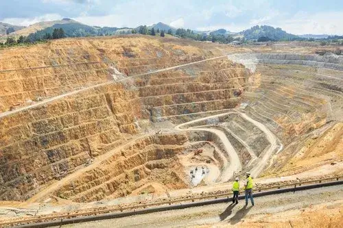
Minor Mineral Drone Survey Rajasthan
Minor Mineral Drone Survey
Rajasthan Minor Mineral Concession (Second Amendment) Rules, 2024, On October 24, 2024, the Mines and Petroleum Department of Rajasthan announced significant amendments to the Rajasthan Minor Mineral Concession Rules, 2017.
1. Introduction
All mining leases of minor minerals must conduct a drone survey of their mining lease up to 100 meters outside the lease boundary. This regulation aims to standardize aerial surveying across the mining sector, promoting precise land use, accurate record-keeping, and identifying illegal mining activities.
Key Requirements:
* Every lessee must annually conduct a drone survey of their mining lease area up to 100 meters outside the boundary.
* This survey must be completed in April or May each year and submitted as part of the annual return.
Mandatory Digital Aerial Images Submission
Starting April 1, 2025, lessees must conduct drone surveys before submitting mining plans or modifications. This aims to ensure accurate and up-to-date data for approvals.
Key Points:
* If lessees provide satellite images before submitting their mining plan, they are exempt from the drone survey requirement.
* Successful bidders must also submit a drone survey of their auctioned plots.
Enhanced Inspection Powers and Volumetric Assessments
The amendments also expand the powers of mining authorities regarding inspections and the assessment of mineral stocks. New provisions allow authorities to conduct volumetric assessments if illegal stocks are suspected.
What’s New?
* Authorities can now use drone surveys or GPS technology for area demarcation and volumetric assessments.
* A new fee structure for demarcation services has been introduced, with specific rates set for both new applications and re-verifications.
6. Standard Operating Procedures for Drone Surveys
The Director will establish standard operating procedures for conducting drone surveys, ensuring consistency and reliability in data collection.
Effective Date: October 24th 2024.

how we help you with the Minor mineral survey?
Efficiently map and analyze mine minerals with our advanced drone surveys, ensuring precise data, faster assessments, and improved decision-making for optimal resource management.
Ready to start?
Today to discuss your project and see how we can make it a success!
All queries are replied within 24hrs.
