Aerial Intelligence For Mining
Mining Survey
Garud Survey revolutionizes the landscape of mining operations by leveraging advanced drone technology, providing an unprecedented level of efficiency and accuracy. Our commitment to excellence is evident in the instant delivery of precise site condition data, achieved through state-of-the-art drones. Specializing in the drone mine survey, we tailor our solutions to meet specific needs, offering comprehensive services ranging from progress monitoring and detailed mapping to accurate measurements of extractable volumes.
Our technology is customized for each project, avoiding a one-size-fits-all approach. We surpass traditional methods such as GNSS surveys with advanced techniques like aerial images, point clouds, and 3D reconstructions, delivering precise stock assessments during monthly solutions or year-end audits.
Garud Survey ensures unparalleled transparency and accountability in inventory reporting. Our drone technology and post-processing software deliver unbiased results, facilitating precise verification of subcontractor activities.
In essence, Garud Survey is not just a provider of drone services; we are your strategic partner in mining excellence. Trust us to deliver innovative solutions that go beyond industry standards, taking your mining projects to unparalleled heights of efficiency and accuracy.
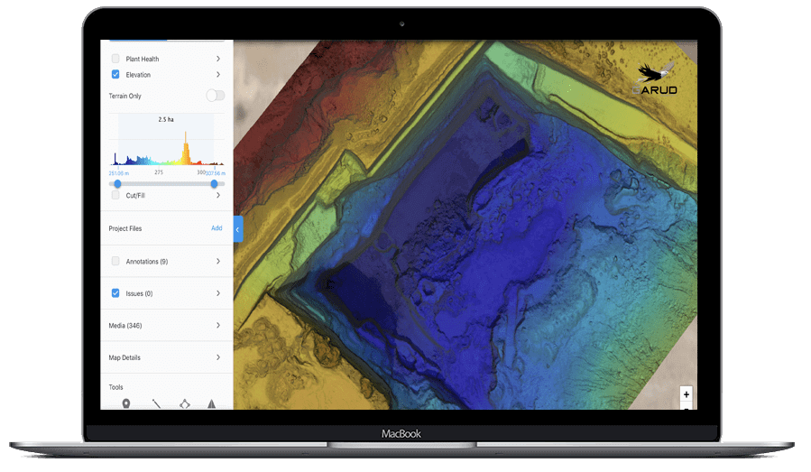
Stockpile Analysis
- Measure stockpile for a fraction of the cost of conventional method
- Improve reliability of data and the volume estimation accuracy is about 98%
- Measure linear distances and area all from a single Workspace
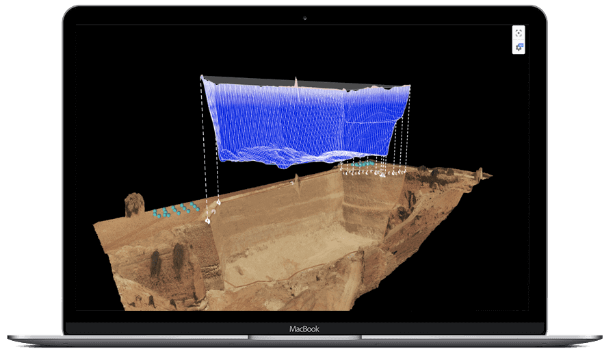
- Visualize calculated base plane in 3D to ensure Volumetric Quality assurance
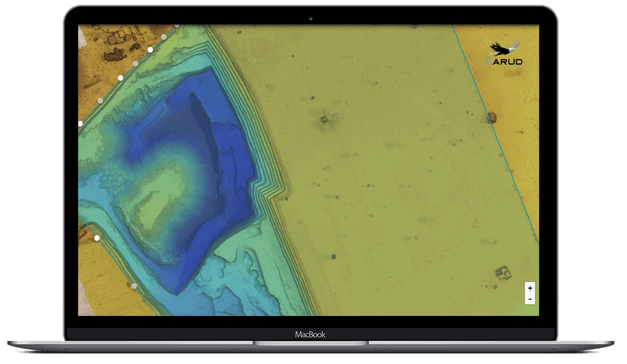
Mine Planning
- Track progress of excavation to update your team and mining the production schedule
- Improve reliability of data and the volume estimation accuracy is about 98%
- Measure linear distances and area all from a single Workspace
- Visualize calculated base plane in 3D to ensure Volumetric Quality assurance
Compliance and Safety
- Fly from a single location and can fly over active operations
- Record Ultra HD 4K Video of Blasting without any risk
- Conduct regular mine and assets inspection efficiently
- Provide site data up to date and make aware for an emergency situation
Aerial Inspection
- Inspect the mine activity of 10 Km radius from a single location
- High Resolution Aerial Video help to analyse blast behaviour and material flow
- Regular aerial inspection can easily track the changes over a period
- Aerial inspection can cover 500+ Hectare area in a single day
Garud Survey: India's Best Drone Survey Company In Mining
Garud Survey is the foremost drone solutions company in India that offers highly accurate and extensive GIS surveying, topographic surveying, drone inspections, drone mapping, powerline monitoring, smart city surveying, road inspections and surveys, mining surveying, flood assessment, property monitoring, solar thermal inspections, security and surveillance, crop health monitoring, volumetric measurement, drone 3D mapping and modeling, aerial photography, videography, and many other advanced drone technologies and survey in mining sector mining drone, drone topographic survey, drones for mining exploration, UAV aerial surveying, drone mine survey, and drone mining. It provides meaningful data for businesses utilizing the latest drone technology. Since 2019, Garud Survey has been providing high-quality drone surveying and mapping services in Jaipur and Udaipur (Rajasthan), Lucknow (Uttar Pradesh), Haryana, Uttarakhand, Mumbai (Maharashtra), Rajkot (Gujarat) and Srinagar (Jammu and Kashmir) regions and other states.
FAQ?
A drone mine survey is a method of surveying mining sites using unmanned aerial vehicles (UAVs) or drones. These drones are equipped with various sensors and cameras to collect data and provide valuable insights for the mining industry.
Drones offer several advantages for mine surveys, including aerial survey cost, safety, and the ability to access hard-to-reach areas. They can capture high-resolution imagery and generate accurate 3D models of the mining site.
Drone mine surveys provide real-time data, enabling mine operators to make informed decisions, optimize operations, and enhance safety measures. They reduce the need for manual labor and offer a non-invasive way to monitor mining activities.
Selecting the right drones for mining exploration depends on factors like the size of the mining area, required sensors, and the specific data you need. Consult with a drone expert or company to find the best solution for your needs.
Yes, drone mine surveys can be more environmentally friendly compared to traditional methods. They reduce the ecological impact and minimize disturbances to the natural environment.