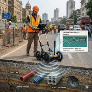
lidar survey
LiDAR vs Photogrammetry for Topographic Survey: Which Technology is Better for Infrastructure Projects?
LiDAR vs Photogrammetry: What is the Real Difference? When creating a topographic map for highways, railways, transmission lines, solar parks, mining projects, industrial developments, or