Aerial Intelligence For Agriculture
Agriculture Survey
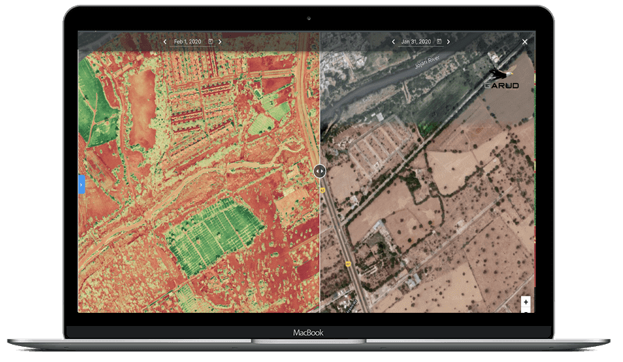
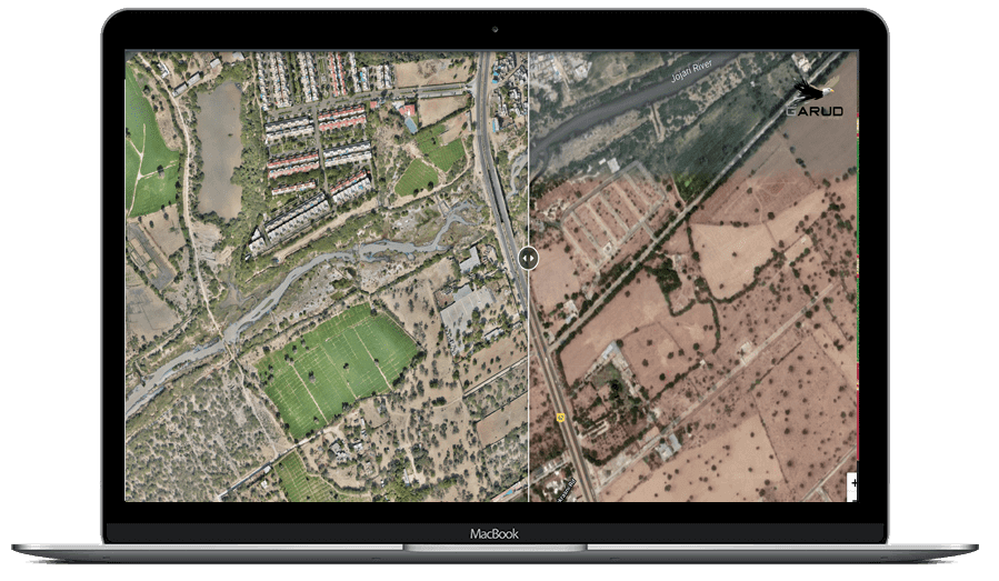
Garud Survey pioneers advanced drone survey services, transforming agricultural practices by providing an immediate view of extensive landscapes. Our technology expedites tasks traditionally time-consuming, covering hundreds of hectares in a single flight. This yields crucial data for pinpointing crop stress factors.
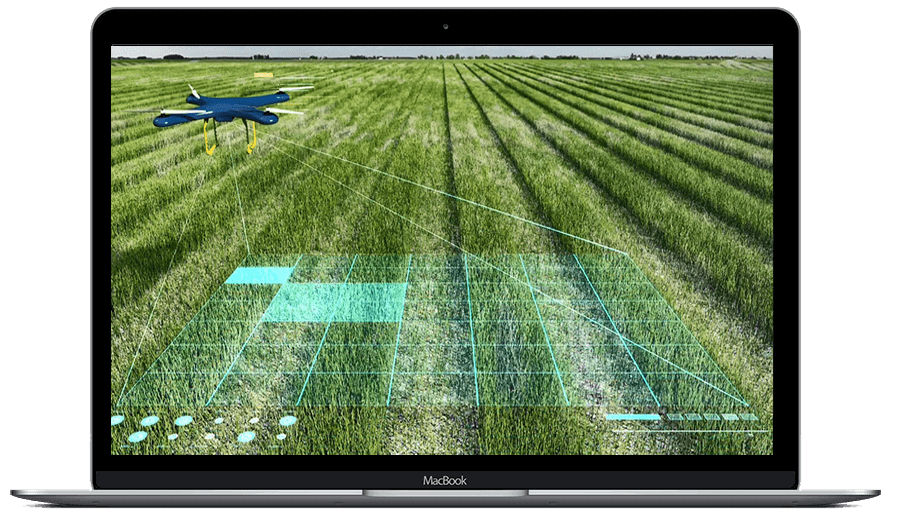
Our drones for agriculture services prove advantageous for farmers, enabling precise land size calculations, crop classification, and optimized harvesting plans. In India’s landscape, where over 35 drone start-ups strive to elevate standards, Garud Survey stands out as a reliable partner.
For growers, service providers, and researchers, our surveys offer swift means to locate crops, identify stress areas, and monitor plant growth. Equipped with high-resolution RGB cameras, we detect and quantify crop health issues early on, contributing to reduced costs and increased yields.
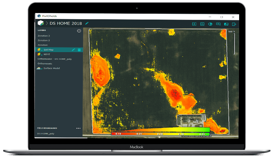
Garud Survey’s data guides precise treatment strategies, seamlessly integrating with agronomy tools. From soil/leaf sampling to continuous insights, our calibrated multispectral sensors empower farmers and researchers. Embrace precision in agriculture with the Garud Survey, where innovation meets efficiency.
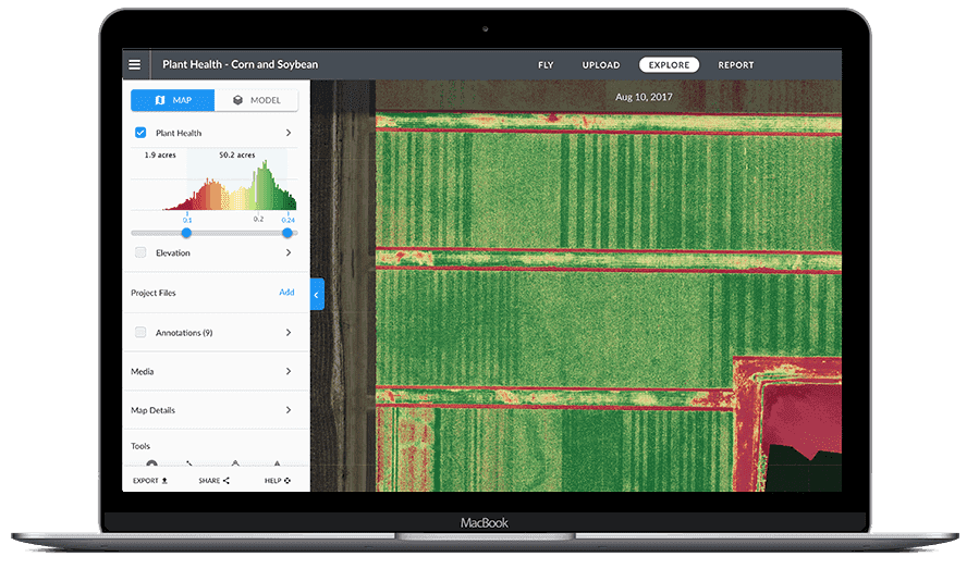
Crop Health Inspection
- Informed and Multispectral data can identify areas of the Crop that are stressed
- Aerial data capture crop Vitality and crop damage assessment
- Identify the crop stress before Visual Signs Occur
Automatic Crop Detection
- Drones are Fast and efficient way to Scout the Crops
- Provide a more accurate, real time analysis of Crop yields and potential threats including diseases
- Provide detailed snapshot of crops that help in pinpoint problem areas
Smart Crop Scouting
- Drones are Fast and efficient way to Scout the Crops
- Provide a more accurate, real time analysis of Crop yields and potential threats including diseases
- Provide detailed snapshot of crops that help in pinpoint problem areas
Irrigation Monitoring and Planning
- Use drone maps, digital Surface models and terrain models for irrigation and drainage planning
- Multispectral data can help to identify leaky irrigation areas that need more water
- Plant Counting algorithms can accurately provide inventory information and help predict Yield
Crop Insurance Report
- High Resolution drone data provide accurately reporting events that lead to economic loss such as Crop Injury
- Provides Critical information for measuring and documenting damage of crop caused by floods, fire, pests, Weather events etc
- These exports are available - DXF,SHP,JGP,LAS,DEM,RCP,TIFF
Garud Survey: India's best Drone Survey Company in Agriculture Sector
Garud Survey is the foremost drone solutions company in India that offers highly accurate and extensive GIS surveying, topographic surveying, drone inspections, drone mapping, powerline monitoring, smart city surveying, road inspections and surveys, mining surveying, flood assessment, property monitoring, solar thermal inspections, security and surveillance, crop health monitoring, volumetric measurement, drone 3D mapping and modeling, aerial photography, videography, and many other advanced drone technologies and survey in agriculture sector drone agricultural survey, drones for agriculture, crop inspection, damage mapping for insurance. It provides meaningful data for businesses utilizing the latest drone technology. Since 2019, Garud Survey has been providing high-quality drone surveying and mapping services in Jaipur and Udaipur (Rajasthan), Lucknow (Uttar Pradesh), Haryana, Uttarakhand, Mumbai (Maharashtra), Rajkot (Gujarat) and Srinagar (Jammu and Kashmir) regions and other states.
FAQ?
Drones provide numerous advantages in agriculture, such as increased efficiency in rop Inspection, precision spraying, and data collection for better decision-making. They help reduce operational costs and improve crop yields.
Drones equipped with cameras and sensors can capture high-resolution images of crops. This data helps farmers detect issues like pest infestations, nutrient deficiencies, or diseases, enabling timely intervention.
Agricultural drones come in various types, including multi-rotor drones for close-range inspection, fixed-wing drone agricultural survey, and hybrid drones combining features of both.
Yes, drones can precisely apply fertilizers, pesticides, and herbicides to specific areas in the field, minimizing wastage and ensuring even distribution.
Yes, using drones for agriculture is subject to regulations, which vary by country. It’s essential to be aware of and comply with local laws and obtain any necessary permits.