Aerial Intelligence For Solar
Solar Industry Survey
Garud Survey plays a pivotal role not only in optimizing photovoltaic (PV) systems but also in enhancing the surrounding infrastructure, encompassing utility lines, substations, and fencing. Throughout key stages like pre-erection, commissioning, and operation and maintenance, our surveys serve invaluable purposes.
The primary focus is on identifying damaged solar panels within their warranty period, facilitating manufacturers to promptly restore or replace them. This proactive approach maximizes the overall output and efficiency of the solar farm while effectively reducing maintenance costs.
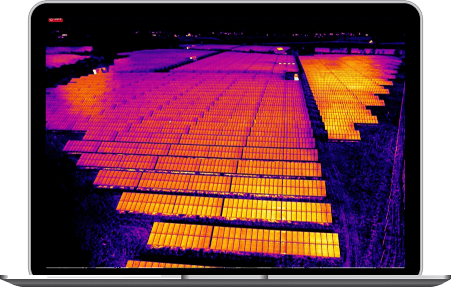
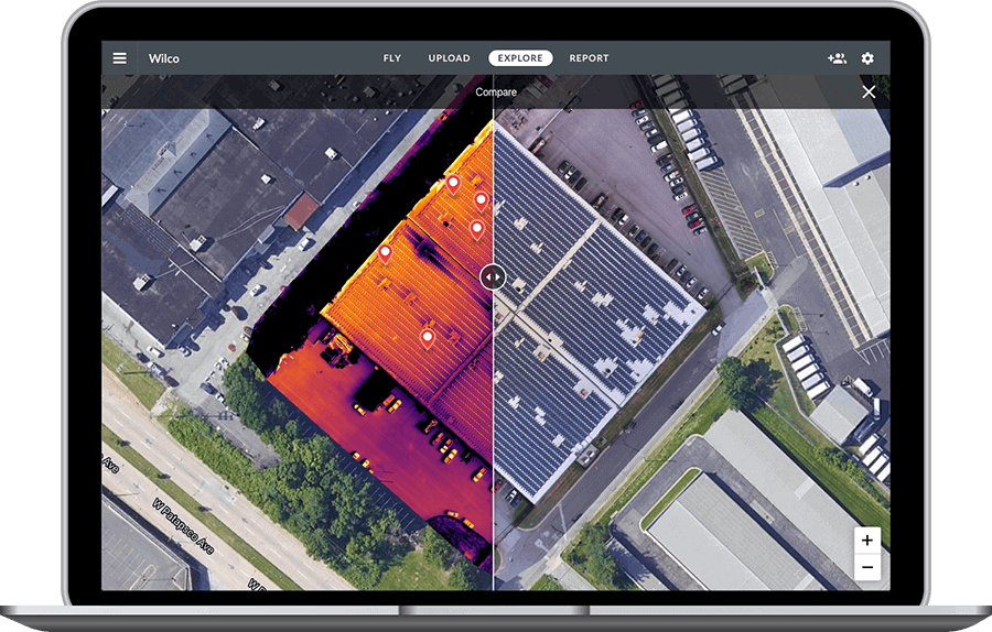
Garud Survey employs drone-based thermal imaging and aerial inspection for swift, cost-effective, and detailed assessments. In solar farm inspection, this approach allows quick scanning for easy hotspot identification, indicating faulty cells. Geotagged images provide valuable diagnostic insights, aiding in the planning of optimal panel placement.
Garud Survey’s infrared signatures reveal defective solar panels, ensuring timely identification and resolution for peak efficiency in solar farm operations. Pre-selected waypoints streamline inspections, saving time while maintaining thorough evaluation.
In essence, Garud Survey’s comprehensive approach to solar farm inspection, powered by drone technology, not only enhances overall performance but also contributes to the longevity of the installation.

Solar Panel Inspection
- Inspect solar Panels for damage and mechanical Failure with thermal and Visual both imagery
- Minimize the maintenance and keep the site at peak efficiency
- Boost team efficiency by sharing real time
Solar Site Construction
- Get survey grade accurate data and digital terrain model to accelerate the construction process
- Improve accuracy of cut and fill estimates with high resolution topographic data
- Reduce bidding timeline with up-to-date aerial imagery and accurate aerial data

Garud Survey: India's Best Drone Survey Company In Solar Industry
Garud Survey leads the solar survey sector with its holistic approach and cutting-edge technology. Our services go beyond the photovoltaic system, assessing and optimizing the entire solar infrastructure. Proactively identifying damaged panels within warranty periods, we utilize drone-based thermal imaging for swift and cost-effective assessments. Geotagged images aid in diagnostic planning, while our streamlined inspection process and commitment to sustainability contribute to prolonged efficiency and reduced environmental impact, solidifying Garud Survey as the premier choice for comprehensive and innovative solar farm inspections.
FAQs?
Drones can gather various data types, including high-resolution imagery, thermal imaging, LiDAR scans, and infrared data, essential for site planning, panel inspection, and performance monitoring.
Drone surveys offer quick and accurate site assessments, aiding in optimal panel placement, shading analysis, maintenance detection, and overall efficiency improvements.
Yes, significantly. Drones reduce surveying time, manpower, and resources, lowering overall costs for site analysis, monitoring, and maintenance.
Absolutely. Drones can inspect panels for damage, dirt accumulation, or defects, allowing for targeted maintenance and ensuring optimal energy production.
Yes, compliance with aviation and local regulations is crucial. Certified operators, flight permissions, and adherence to safety guidelines are essential for legal and safe operations.
