The challenges we face in environmental conservation today call for innovative solutions that allow us to monitor, protect, and preserve our natural ecosystems with accuracy and efficiency. Drones, also known as unmanned aerial vehicles (UAVs), have emerged as a groundbreaking tool in this field, bringing a new level of precision and reach to conservation efforts. At Garud Survey Private Limited, we are committed to supporting environmental sustainability by providing drone services that empower conservationists to tackle these complex challenges more effectively.
The Impact of Drones on Environmental Conservation
Traditional methods of monitoring environmental changes often involve large-scale, ground-based surveys that can be labor-intensive, time-consuming, and expensive. Drones offer a more efficient alternative, enabling researchers and conservationists to cover vast areas quickly, collect high-resolution data, and access difficult-to-reach or fragile ecosystems without disturbing the wildlife or environment.
From tracking wildlife populations to monitoring deforestation, drones provide conservationists with essential tools to gather critical data, spot trends, and make informed decisions. By deploying drones, conservation teams can achieve their goals more quickly and efficiently, allowing for a broader, more comprehensive approach to environmental protection.
Key Applications of Drones in Conservation
At Garud Survey Private Limited, we understand that each conservation project is unique. Our drone services are tailored to meet the specific needs of various environmental conservation initiatives. Here are some of the ways drones are transforming conservation efforts:
- Wildlife Monitoring and Protection: Drones are being used extensively to monitor wildlife populations and track their movements, especially for endangered species in remote or protected areas. Traditional methods of tracking, such as tagging or in-person monitoring, can be invasive and stressful for animals. Drones offer a non-intrusive solution by observing animals from the sky, which allows researchers to gather valuable data on population sizes, migration patterns, and behaviors without disturbing the animals. In anti-poaching efforts, drones can also monitor high-risk areas in real time, allowing authorities to detect and respond to threats swiftly.
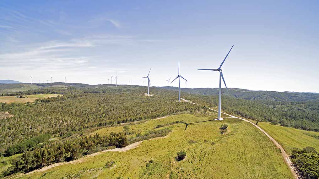
- Forest Conservation and Deforestation Monitoring: Forests are crucial for regulating climate, supporting biodiversity, and storing carbon. However, illegal logging and deforestation pose a serious threat to these ecosystems. Drones provide an effective way to monitor large forested areas and detect any signs of illegal activities or environmental degradation. Using aerial images, drones can identify changes in forest cover over time, enabling conservationists to assess the impact of deforestation and develop better forest management strategies.
- Restoration of Ecosystems: Drones play a critical role in reforestation efforts by assisting in aerial seeding—an innovative technique where seeds are dispersed over a targeted area from the air. By reaching locations that may be inaccessible by foot, drones can help replant trees over large swathes of land quickly and efficiently. This technique has proven particularly beneficial in areas that have experienced extensive wildfires or other forms of environmental damage, as it accelerates the reforestation process and promotes ecosystem recovery.
- Coastal and Marine Conservation: Drones equipped with advanced sensors and cameras are used to monitor coastal ecosystems, including coral reefs, mangroves, and beaches. These ecosystems are vulnerable to pollution, rising sea levels, and other impacts of climate change. By capturing detailed images and data, drones help conservationists detect changes in coastline patterns, assess coral bleaching, and monitor marine wildlife populations. This data is invaluable for studying the impact of climate change on marine environments and developing strategies for their preservation.
- Disaster Response and Recovery: Natural disasters such as wildfires, floods, and hurricanes can devastate ecosystems and threaten wildlife. Drones can be quickly deployed to survey affected areas, assess damage, and provide real-time data to aid in disaster response and recovery efforts. By capturing aerial images and mapping disaster zones, drones help responders prioritize areas for intervention and allocate resources more efficiently. In the aftermath of a disaster, drones are also used to monitor ecosystem recovery, ensuring that conservation efforts are effectively restoring the affected environment.
The Advantages of Using Drones in Conservation
The benefits of drones for conservation are significant, and at Garud Survey Private Limited, we are dedicated to making these advantages accessible to organizations working to protect the environment. Here are some key benefits:
- Cost-Effectiveness: Drones provide a much more affordable alternative to traditional methods of data collection, such as helicopters or manned aircraft. By reducing the need for costly equipment and manpower, drones make it possible to conduct large-scale monitoring at a fraction of the cost.
- Accuracy and Precision: Equipped with high-resolution cameras, LiDAR, and other advanced sensors, drones are capable of capturing precise data and producing detailed 3D maps. This level of accuracy is crucial for detecting subtle changes in ecosystems and tracking environmental trends over time.
- Access to Difficult Areas: Many conservation areas are located in remote or hazardous terrains, such as dense forests, mountains, or wetlands. Drones can easily access these areas, allowing conservationists to collect data without putting themselves or the environment at risk.
- Real-Time Data Collection: Drones can transmit data in real time, allowing conservation teams to monitor situations as they unfold. This real-time capability is particularly useful for anti-poaching efforts, wildfire management, and other time-sensitive operations where quick decision-making is critical.
The Future of Drones in Environmental Conservation
As drone technology continues to advance, the possibilities for their application in conservation will only grow. Future innovations in drone technology, such as AI-powered image recognition and enhanced data analytics, will further improve the ability of drones to detect patterns, monitor environmental changes, and assist in predictive modeling for conservation planning.
At Garud Survey Private Limited, we are committed to being at the forefront of this technological evolution. By investing in cutting-edge UAVs and customizing our services to meet the needs of conservationists, we aim to empower environmental organizations with the tools they need to make a positive impact on our planet.
Conclusion
Drones have become an indispensable asset in the field of environmental conservation, offering a powerful, efficient, and cost-effective way to monitor and protect natural ecosystems. From wildlife monitoring to forest conservation and disaster response, drones provide conservationists with the data they need to address environmental challenges effectively. At Garud Survey Private Limited, we are proud to support these efforts, helping conservation teams leverage drone technology to preserve the earth’s biodiversity and natural resources.
As we look to the future, we remain dedicated to exploring new ways drones can benefit environmental conservation. By partnering with organizations and researchers, we aim to help secure a sustainable future where technology and nature work hand in hand for a healthier planet.


