
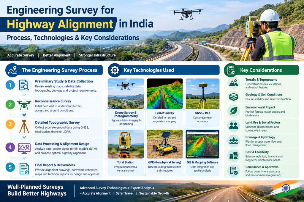
Engineering Survey for Highway Alignment in India: Process, Technologies & Key Considerations
Planning a highway is not simply about deciding where a road should be built. The selected alignment must work with the terrain, drainage, existing infrastructure, land requirements, geological conditions, environmental constraints and engineering design requirements. This is why an Engineering Survey for Highway Alignment in India is an essential part of highway planning and development.