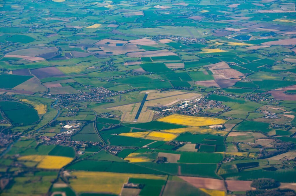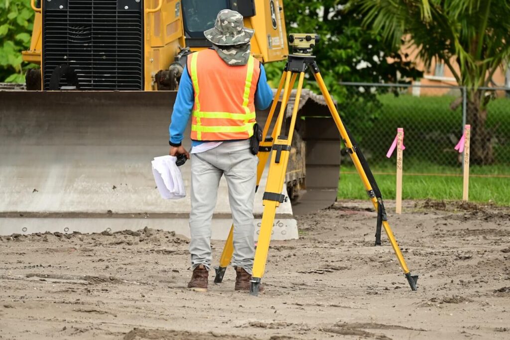
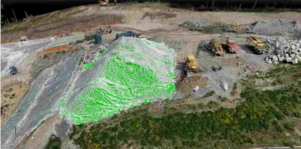
Lucknow, the City of Nawabs, is rapidly transforming into a modern urban hub. With ongoing infrastructure projects, road development, real estate expansion, smart city initiatives, and large-scale urban planning, the demand for accurate, fast, and reliable land mapping solutions has never been higher. This is where drone survey and Aerial LiDAR Survey in Lucknow & Uttar Pradesh are making a significant impact.
By combining UAV technology, LiDAR sensors, high-resolution cameras, GNSS/RTK positioning, GIS, and advanced 3D data processing, modern aerial surveys provide detailed information about terrain, buildings, roads, vegetation, utilities, and other important features. These datasets help engineers, planners, architects, developers, and government agencies make better decisions throughout the project lifecycle.
At Garud Survey Private Limited, we provide professional drone surveying, Aerial LiDAR surveying, mapping, and geospatial solutions for infrastructure, construction, urban development, transportation, mining, power, agriculture, and environmental projects across Lucknow and Uttar Pradesh.
What is a Drone Survey?
A drone survey uses unmanned aerial vehicles (UAVs) equipped with high-resolution cameras and advanced sensors to capture aerial imagery and spatial information. The collected data can be processed into orthomosaic maps, 2D maps, 3D models, digital elevation models (DEM), digital surface models (DSM), point clouds, and topographic maps.
Compared with many conventional ground-based surveying workflows, drone surveys can cover large areas quickly while reducing the need for extensive fieldwork. They are particularly useful for construction monitoring, land mapping, infrastructure inspection, volumetric calculations, and topographic surveys.
What is Aerial LiDAR Survey?
Aerial LiDAR Survey is an advanced remote-sensing technique that uses laser pulses mounted on an aircraft or UAV to measure the distance between the sensor and the Earth’s surface. The system records millions of measurements to create a highly detailed 3D point cloud of the surveyed area.
Unlike conventional aerial photography, LiDAR can provide valuable elevation information even in areas containing vegetation. This makes it particularly useful for terrain modelling, corridor mapping, drainage studies, flood assessment, road projects, transmission corridors, and large-scale infrastructure development.
For projects requiring detailed terrain information, an Aerial LiDAR Survey in Lucknow can provide engineers and planners with high-density elevation data that supports accurate design and analysis.
Aerial LiDAR Survey in Lucknow & Uttar Pradesh
The rapid development of Lucknow and other cities across Uttar Pradesh has increased the need for reliable geospatial information. New highways, roads, residential developments, industrial areas, drainage networks, railway infrastructure, and urban expansion require accurate terrain and elevation data before construction begins.
A professional Aerial LiDAR Survey in Lucknow & Uttar Pradesh can support these projects by providing:
- High-density 3D LiDAR point clouds
- Digital Elevation Models (DEM)
- Digital Surface Models (DSM)
- Digital Terrain Models (DTM)
- Contour generation
- Accurate topographic mapping
- 3D terrain visualization
- Road and corridor mapping
- Vegetation and terrain analysis
- Drainage and watershed analysis
- Cut-and-fill and earthwork calculations
- GIS-ready spatial datasets
These deliverables can be integrated with CAD, GIS, BIM, and engineering design workflows depending on project requirements.
Why Aerial LiDAR Survey is Important for Urban Development
Urban areas contain complex combinations of buildings, roads, utilities, vegetation, open spaces, and changing terrain. Conventional surveying methods may require considerable fieldwork to capture all these elements.
An Aerial LiDAR Survey in Uttar Pradesh provides a data-rich view of the project area and can help organizations understand existing ground conditions before making important planning and engineering decisions.
Key applications include:
Urban Planning:
LiDAR-derived terrain and elevation datasets can support master planning, land-use analysis, infrastructure planning, and urban expansion studies.
Road and Highway Development:
LiDAR data can be used for corridor mapping, terrain profiling, road alignment studies, cross-sections, slope analysis, and engineering design.
Drainage and Flood Assessment:
Accurate elevation data helps identify low-lying areas, drainage paths, water accumulation zones, and terrain characteristics relevant to flood-risk assessment.
Construction and Real Estate:
Developers can use aerial survey data for site planning, progress monitoring, terrain modelling, and quantity calculations.
Railway and Transportation Corridors:
LiDAR surveying can efficiently capture long corridors and generate detailed terrain information for preliminary planning and engineering studies.
Power and Utility Mapping:
Aerial data can support corridor surveys, vegetation assessment, infrastructure mapping, and inspection-related applications.
Benefits of Aerial LiDAR Survey in Uttar Pradesh
For large infrastructure and engineering projects, LiDAR provides several important advantages:
1. Detailed 3D Terrain Information
LiDAR generates millions of elevation measurements, allowing the creation of detailed three-dimensional representations of the surveyed environment.
2. Faster Data Acquisition
Large and difficult-to-access areas can be surveyed efficiently using UAV or aerial LiDAR platforms, reducing extensive field operations.
3. Improved Terrain Analysis
LiDAR-derived datasets are useful for generating contours, DTMs, slope maps, elevation profiles, and other engineering outputs.
4. Useful in Vegetated Areas
One of the major advantages of LiDAR is its ability to collect laser-return information that can help characterize terrain beneath vegetation, subject to vegetation density, sensor configuration, and survey conditions.
5. Better Engineering Decisions
Accurate spatial and elevation data gives project teams a stronger foundation for route planning, design, earthwork estimation, drainage studies, and construction planning.
6. Reduced Field Risk
Aerial data collection can reduce the requirement for personnel to enter difficult, hazardous, or inaccessible areas during initial surveying and inspection activities.
Drone Survey vs Aerial LiDAR Survey
Both drone photogrammetry and LiDAR have important applications, but the right technology depends on the project’s objectives.
Drone photogrammetry is highly effective when detailed visual imagery, orthomosaics, textured 3D models, and economical mapping are required.
LiDAR surveying is particularly valuable when accurate elevation information, high-density point clouds, terrain modelling, corridor mapping, and complex topographic analysis are priorities.
For some projects, combining drone photogrammetry and LiDAR can provide both detailed visual information and high-quality elevation data.
Applications of LiDAR Survey in Lucknow
The growing infrastructure ecosystem of Lucknow creates numerous applications for LiDAR technology. LiDAR Survey in Lucknow can be used for:
- Urban infrastructure planning
- Highway and road alignment surveys
- Railway corridor surveys
- Smart city projects
- Real estate development
- Industrial infrastructure
- Drainage and flood studies
- River and watershed mapping
- Power transmission corridors
- Mining and quarry surveys
- Construction site mapping
- Earthwork and volumetric calculations
- Digital terrain modelling
- Environmental assessment
Industries We Serve in Lucknow & Uttar Pradesh
Garud Survey Private Limited provides customized drone survey and Aerial LiDAR Survey services in Lucknow and Uttar Pradesh for a wide range of industries, including:
- Government and urban development authorities
- Real estate and construction
- Roads and highways
- Railways and transportation
- Mining and quarrying
- Power and energy
- Agriculture and forestry
- Environmental projects
- Industrial infrastructure
- Smart city and GIS projects
Our survey solutions can be customized according to the project’s area, terrain, accuracy requirements, sensor selection, and required deliverables.
Aerial LiDAR Survey Workflow
A professional LiDAR survey generally involves several stages, from project planning to final data delivery.
Project Planning
The survey area, required accuracy, terrain, deliverables, control points, flight parameters, and sensor requirements are determined.
Data Acquisition
The LiDAR-equipped UAV or aerial platform collects laser measurements and positioning data across the project area.
Ground Control and Positioning
GNSS/RTK/PPK and suitable survey control procedures can be used to improve the positional quality of the collected dataset.
Point Cloud Processing
Raw LiDAR observations are processed, calibrated, classified, and converted into a usable point cloud.
Terrain Modelling
Depending on project requirements, the point cloud can be used to generate DTM, DSM, DEM, contours, profiles, and 3D terrain models.
Final Deliverables
The processed information can be supplied in suitable formats for GIS, CAD, engineering, planning, and further analysis.
Why Choose Garud Survey Private Limited?
At Garud Survey Private Limited, we combine modern UAV technology, LiDAR systems, surveying expertise, GIS capabilities, and professional data processing to deliver practical geospatial solutions.
Our focus is not simply on collecting aerial data but on producing accurate and usable information that supports engineering, planning, construction, and infrastructure decisions.
Key advantages include:
- Advanced drone and LiDAR survey technology
- Experienced surveying and GIS professionals
- High-density 3D spatial data
- Customized survey solutions
- Detailed mapping and modelling outputs
- Support for large and complex project areas
- Efficient data collection and processing
- Professional project documentation
Why Choose Aerial LiDAR Survey in Lucknow & Uttar Pradesh?
As Uttar Pradesh continues to invest in transportation, urban infrastructure, industrial development, housing, and smart-city initiatives, high-quality geospatial information is becoming increasingly important.
Aerial LiDAR provides project teams with detailed elevation and three-dimensional information that can improve site understanding before design and construction. When combined with drone imagery, GIS, GNSS, and other surveying technologies, it can create a comprehensive digital representation of the project area.
For organizations searching for Aerial LiDAR Survey in Lucknow, Aerial LiDAR Survey in Uttar Pradesh, LiDAR Survey Company in Lucknow, or professional drone survey services in Lucknow, Garud Survey Private Limited offers technology-driven surveying and mapping solutions tailored to project requirements.
Frequently Asked Questions
What is an Aerial LiDAR Survey?
An Aerial LiDAR Survey uses laser pulses from an aerial platform to measure terrain and surface features. The collected measurements are processed into high-density 3D point clouds and elevation-based mapping products.
Where is Aerial LiDAR Survey used in Uttar Pradesh?
Aerial LiDAR can be used for highways, roads, railways, urban planning, construction, drainage studies, flood assessment, power corridors, mining, environmental mapping, and other infrastructure projects.
What deliverables can be generated from LiDAR data?
Depending on project requirements, deliverables may include point clouds, DEM, DSM, DTM, contours, elevation profiles, 3D terrain models, classified datasets, and GIS/CAD-compatible outputs.
Is LiDAR better than traditional surveying?
LiDAR is not a universal replacement for ground surveying. Its advantage is its ability to rapidly collect dense three-dimensional elevation data over large or difficult areas. The appropriate technology depends on project accuracy, terrain, scale, and required deliverables.
Can LiDAR be combined with drone photogrammetry?
Yes. Combining LiDAR with high-resolution drone imagery can provide both detailed visual information and elevation data, making the approach useful for complex mapping and infrastructure projects.
How can I get an Aerial LiDAR Survey in Lucknow?
You can contact Garud Survey Private Limited to discuss your project area, survey requirements, expected accuracy, terrain, and required deliverables. The survey methodology and sensor configuration can then be selected according to the project’s technical requirements.
Conclusion
The future of land mapping, infrastructure planning, and urban development is increasingly data-driven. As Lucknow and other parts of Uttar Pradesh continue to grow, drone surveying and Aerial LiDAR Survey technology can provide the detailed spatial and elevation information required for smarter planning and more efficient project execution.
Whether the requirement is urban mapping, highway corridor surveying, topographic mapping, terrain modelling, drainage analysis, construction monitoring, or infrastructure development, advanced aerial surveying can significantly improve project visibility and decision-making.
With Garud Survey Private Limited, organizations can access professional Aerial LiDAR Survey services in Lucknow and Uttar Pradesh, supported by modern surveying technology, GIS expertise, and project-focused data processing.
Looking for Aerial LiDAR Survey in Lucknow or across Uttar Pradesh? Contact Garud Survey Private Limited for a customized survey solution based on your project requirements.