Introduction
In recent years, drone surveys have revolutionized land surveying, construction, agriculture, and infrastructure projects by offering faster, safer, and more cost-effective solutions compared to traditional methods. However, one of the most common questions businesses and individuals have is: How much does a drone survey cost? At Garud Survey, we provide transparent pricing and high-quality drone surveying services tailored to your project needs.
This article explores the factors influencing drone survey costs, the benefits of choosing drone-based surveys, and why Garud Survey is the best choice for affordable and accurate aerial mapping.
Factors Affecting Drone Survey Cost
The cost of a drone survey depends on several variables, including:
1. Project Size & Complexity
Larger areas require more flight time and data processing, increasing costs.
Complex terrains (hilly areas, dense forests, urban zones) may need advanced sensors like LiDAR, raising the price.
2. Type of Survey & Data Required
2D Orthomosaic Maps (basic aerial imagery) are more affordable.
3D Models & Digital Terrain Models (DTMs) require advanced processing, increasing costs.
Thermal & Multispectral Surveys (for agriculture or solar inspections) involve specialized cameras, adding to expenses.
3. Resolution & Accuracy Needs
Higher-resolution imagery (1cm/pixel vs. 5cm/pixel) costs more due to increased flight time and processing.
Survey-grade accuracy (using RTK/PPK drones) is pricier than standard GPS-based surveys.
4. Frequency of Surveys
One-time surveys are cheaper, while ongoing monitoring (e.g., construction progress tracking) may require a subscription model.
5. Location & Accessibility
Remote or difficult-to-access sites may incur additional travel and logistics costs.
Urban areas may require special permits, affecting pricing.
6. Data Processing & Deliverables
Basic maps cost less, while advanced analytics (volume calculations, contour maps) increase the price.
Average Drone Survey Costs in India (2024)
While prices vary, here’s a general estimate for drone survey costs:
| Type of Survey | Approximate Cost (per acre) |
|---|---|
| Basic Aerial Mapping (2D) | ₹500 – ₹1,500 |
| High-Resolution Topographic Survey | ₹1,500 – ₹3,500 |
| 3D Modeling & Volumetric Analysis | ₹2,000 – ₹5,000 |
| LiDAR Survey (for dense terrain) | ₹5,000 – ₹10,000 |
| Thermal/Multispectral Survey | ₹3,000 – ₹8,000 |
Note: Prices may vary based on project requirements and location.
Why Choose Drone Surveys Over Traditional Methods?
✅ Cost Savings
Traditional land surveys require multiple personnel and days of work, while drones cover large areas in hours, reducing labor costs.
✅ Speed & Efficiency
A drone can survey 100+ acres in a single day, compared to weeks with manual methods.
✅ Superior Accuracy
Advanced GPS and RTK drones provide centimeter-level precision, minimizing errors.
✅ Enhanced Safety
No need for surveyors to access hazardous sites like mines, construction zones, or unstable terrain.
✅ Real-Time Data for Better Decisions
Instant processing allows for quick project adjustments and progress tracking.
Why Garud Survey Offers the Best Drone Survey Pricing?
At Garud Survey, we ensure high-quality drone surveys at competitive rates by:
✔ Using the Latest Technology – Our advanced drones and software optimize efficiency, reducing operational costs.
✔ Tailored Pricing Plans – We customize surveys based on your budget and project scope.
✔ No Hidden Charges – Transparent pricing with no surprise fees.
✔ Fast Turnaround – Quick data processing means you save time and money.
✔ Expert Team – Certified pilots and surveyors ensure accurate, reliable results.
Industries We Serve with Cost-Effective Drone Surveys
️ Construction & Engineering
Site planning, progress monitoring, and as-built verification.
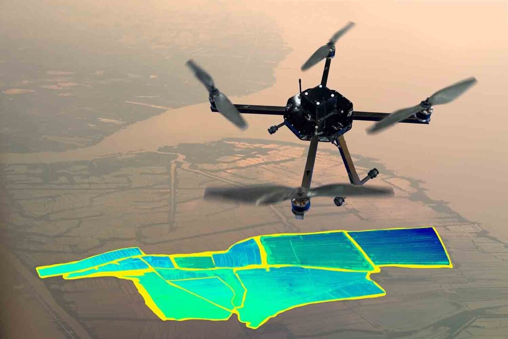
Agriculture & Precision Farming
Crop health analysis, irrigation planning, and yield estimation.
⛏️ Mining & Quarrying
Stockpile measurements, terrain modeling, and volume calculations.
️ Urban Planning & Smart Cities
3D city modeling, land use mapping, and infrastructure development.
Environmental & Forestry
Wildlife tracking, deforestation studies, and erosion monitoring.
Conclusion: Get an Accurate Drone Survey at the Best Price
Drone surveys are a game-changer for industries requiring fast, precise, and affordable geospatial data. While costs vary based on project needs, Garud Survey ensures the best value with cutting-edge technology, expert analysis, and transparent pricing.
Contact Garud Survey today for a free quote! Let us help you save time and money with professional drone surveying solutions.