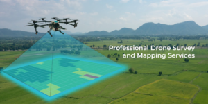
The Future of Land Mapping: Drone Surveys in Haryana
Land surveying has entered a new era with the advent of drone technology. In Haryana, where agriculture, infrastructure, and urban development are rapidly expanding, drone surveys have become an indispensable tool for precise and efficient data collection. Garud Survey, a trusted name in geospatial solutions, offers state-of-the-art Drone Survey in Haryana, helping businesses, farmers, and government agencies make informed decisions with high-quality aerial data.
Why Drone Surveys Are Better Than Traditional Methods?
Traditional land surveys involve manual measurements, which are slow, expensive, and often less accurate. Drones, however, provide a smarter alternative with:
1. Unmatched Speed & Coverage
Drones can survey hundreds of acres in just a few hours, drastically reducing project timelines compared to ground-based surveys.
2. Pinpoint Accuracy
With high-resolution cameras, LiDAR, and GPS-enabled mapping, drones capture data with centimeter-level precision, minimizing errors in land measurements.
3. Cost-Effective Solution
By reducing manpower and equipment costs, drone surveys offer a budget-friendly option for large-scale projects.
4. Safe & Non-Intrusive
Drones can access difficult terrains—such as construction sites, mining zones, and flood-affected areas—without risking human safety.
Key Applications of Drone Survey in Haryana
1. Agricultural Land Assessment
Crop Health Monitoring – Detect diseases, water stress, and nutrient deficiencies early.
Precision Farming – Optimize pesticide and fertilizer usage for higher yields.
Land Records Digitization – Create accurate digital land maps to prevent disputes.
2. Infrastructure & Construction
Topographic Mapping – Essential for road, highway, and urban development projects.
Progress Tracking – Monitor construction sites in real time for better project management.
Volume Estimation – Calculate earthwork and material stockpiles with precision.
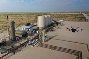
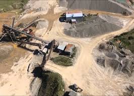
3. Mining & Quarry Surveys
Stockpile Measurement – Accurately assess mined material quantities.
Slope Stability Analysis – Prevent landslides and ensure worker safety.
4. Environmental & Government Projects
Forest & Wildlife Monitoring – Track deforestation and habitat changes.
Disaster Management – Assess flood, earthquake, or fire damage for quick relief efforts.
Why Choose Garud Survey for Drone Services in Haryana?
✔ Advanced Drone Technology – We use the latest drones with multispectral, thermal, and LiDAR sensors.
✔ DGCA-Compliant Operations – All flights are conducted by certified pilots following legal guidelines.
✔ Quick Data Processing – Fast delivery of 2D/3D maps, contour lines, and volumetric reports.
✔ Customized Solutions – Tailored surveys for agriculture, real estate, mining, and urban planning.
Book Your Drone Survey Today!
Whether you’re a farmer, builder, or government official, Garud Survey provides reliable, high-quality Drone Survey in Haryana to meet your needs.
Call Now: +91-7733911999
Visit Us: Garudsurvey.com
✉ Email: info@garudsurvey.com