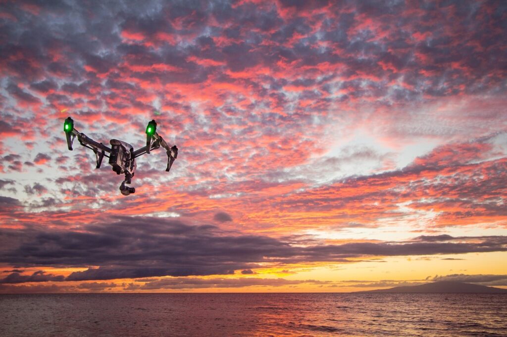
In recent years, drones have revolutionized how archaeologists explore and document ancient sites. This aerial technology, once primarily used for military or surveillance purposes, is now a crucial tool for uncovering the secrets of our past. With the ability to access remote or difficult-to-reach locations, drones provide a new perspective that enhances traditional archaeological methods, allowing experts to survey, map, and analyze sites with remarkable efficiency and precision.
The Role of Drones in Archaeology
Drones, or unmanned aerial vehicles (UAVs), have rapidly gained popularity in archaeological exploration due to their ability to capture high-resolution images, produce detailed 3D models, and cover large areas in a fraction of the time it would take traditional ground-based methods. By flying over historical sites, drones can document landscapes and features that would otherwise be nearly impossible to access. For example, dense jungles, rugged mountains, or areas with unstable or hazardous terrain no longer pose significant challenges for archaeologists when drones are employed.
One of the main benefits of drones is their ability to conduct non-invasive surveys. Archaeologists can use drones equipped with cameras, LiDAR (Light Detection and Ranging) sensors, and thermal imaging technology to detect and document archaeological features without disturbing the site. This non-destructive approach preserves the integrity of the artifacts and structures while enabling researchers to gather critical data.
Aerial Photography and Mapping
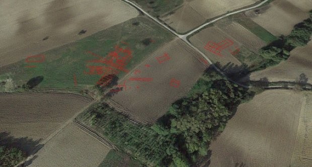
Aerial photography has long been used in archaeology, but drones have taken this technique to new heights. Traditional aerial photography required expensive planes or helicopters to capture high-quality images, a method that was costly and limited in its reach. Drones, however, provide an affordable and efficient solution to this problem. Equipped with high-resolution cameras, drones can capture detailed images from various angles, providing a comprehensive view of the landscape.
The captured images can then be stitched together using photogrammetry software to create detailed maps of archaeological sites. These maps can reveal patterns and structures that may not be immediately visible from the ground, such as buried walls, roads, or ancient water systems. By repeatedly flying over the same site at different times, archaeologists can track changes in the landscape, allowing them to monitor site preservation and identify potential threats.
LiDAR and 3D Modeling
One of the most groundbreaking uses of drones in archaeology is their integration with LiDAR technology. LiDAR uses laser pulses to measure the distance between the drone and the ground, creating a 3D map of the terrain. When employed in dense forests or jungles, LiDAR can penetrate the canopy and reveal ancient ruins hidden beneath thick vegetation. This has led to the discovery of previously unknown archaeological sites, such as Mayan cities in Central America, that were hidden for centuries.
LiDAR data can also be used to create incredibly accurate 3D models of archaeological sites, allowing researchers to virtually explore the site from different angles. These models can be analyzed to understand the layout of ancient cities, the construction techniques used by past civilizations, and the potential locations of undiscovered artifacts. The ability to create and study 3D models has opened up new avenues for research, allowing archaeologists to investigate sites without physically disturbing them.
Enhancing Site Preservation
Another significant advantage of drones in archaeological exploration is their role in site preservation. By documenting sites from the air, archaeologists can create detailed records of their condition over time. This helps to monitor changes caused by natural forces, such as erosion or flooding, as well as human activities like looting or urban development. Drones can also be used to monitor the effectiveness of conservation efforts, ensuring that the preservation work being carried out is having a positive impact on the site’s long-term survival.
In addition to documenting sites, drones can be used to assist in site management. For instance, they can help create high-resolution maps of excavation sites, allowing archaeologists to plan and execute digs more efficiently. Drones can also be employed to monitor crowds at popular tourist destinations, ensuring that visitors do not inadvertently damage fragile archaeological features.
A New Era in Archaeology
The use of drones in archaeology is still in its early stages, but their potential is vast. As drone technology continues to advance, likely, their role in archaeological exploration will only increase. In the future, drones could become even more integrated with other emerging technologies, such as artificial intelligence and machine learning, to further enhance data analysis and decision-making in archaeological research.
From uncovering ancient civilizations hidden beneath dense jungles to preserving and monitoring the sites of our shared human heritage, drones are proving to be invaluable tools in the field of archaeology. With their ability to capture detailed, non-invasive data from above, drones are helping to unlock the mysteries of the past and ensure that these discoveries are preserved for future generations. As technology continues to evolve, the possibilities for drones in archaeological exploration are limitless, ushering in a new era of discovery and understanding of our ancient world.