The rapid advancement of technology has opened new avenues for various industries, and land surveying is no exception. In India, a country with diverse and often challenging terrains, the adoption of drones for land surveying is revolutionizing the field. This innovation is not only enhancing the accuracy and efficiency of surveys but also significantly reducing costs and improving safety. The integration of drones into land surveying practices is proving to be a game-changer, transforming how surveys are conducted across the country.
The Evolution of Land Surveying in India
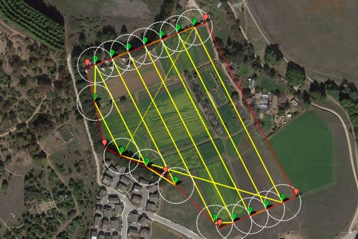
Traditionally, land surveying in India relied on manual methods and ground-based equipment. These techniques, while effective, often involved significant time, labor, and costs. The introduction of drones, or Unmanned Aerial Vehicles (UAVs), has shifted this paradigm by offering a more efficient and precise approach to surveying. Equipped with high-resolution cameras, LiDAR sensors, and other advanced technologies, drones are capable of capturing detailed aerial imagery and data, enabling surveyors to create accurate maps and models with ease.
Benefits of Using Drones for Land Surveying
1. Enhanced Accuracy and Precision
One of the most significant advantages of using drones for land surveying is the level of accuracy they provide. Drones can capture high-resolution images and data points with centimeter-level precision. This accuracy is crucial for creating detailed topographic maps, 3D models, and other essential surveying outputs. The ability to collect such precise data ensures that surveyors can make informed decisions and reduce the likelihood of errors.
2. Time and Cost Efficiency
Traditional land surveying methods can be time-consuming and labor-intensive. Drones, however, can cover large areas quickly and efficiently, significantly reducing the time required for data collection. This speed translates into cost savings, as fewer resources are needed to complete surveys. Additionally, drones can access hard-to-reach or hazardous areas without putting surveyors at risk, further enhancing efficiency and safety.
3. Improved Safety
Surveying often involves working in challenging and potentially dangerous environments. Drones eliminate the need for surveyors to physically enter these areas, reducing the risk of accidents and injuries. This is particularly important in regions with difficult terrains, such as mountains, forests, and remote areas, where traditional surveying methods may pose significant risks.
4. Real-Time Data Collection and Analysis
Drones provide real-time data collection and analysis capabilities, allowing surveyors to monitor and adjust their surveys on the fly. This real-time insight is invaluable for identifying and addressing issues promptly, ensuring that surveys are accurate and comprehensive. The ability to process and analyze data quickly also accelerates project timelines, enabling faster decision-making and implementation.
5. Versatility and Adaptability
Drones are incredibly versatile and can be equipped with various sensors and cameras to suit different surveying needs. Whether it’s capturing high-resolution imagery, conducting thermal imaging, or utilizing LiDAR for detailed topographic mapping, drones can be adapted to provide the specific data required for a wide range of applications. This versatility makes them an ideal tool for land surveying in diverse environments.
Applications of Drones in Land Surveying in India
1. Urban Planning and Development
In urban planning and development, accurate land surveys are essential for assessing land use, planning infrastructure, and managing zoning regulations. Drones provide precise data that helps urban planners visualize and analyze proposed developments, ensuring that growth is sustainable and well-organized. This is particularly important in India’s rapidly expanding cities, where efficient land use is critical for accommodating population growth.
2. Infrastructure Projects
Infrastructure projects, such as road construction, railway development, and pipeline installation, require detailed land surveys to ensure proper planning and execution. Drones can quickly survey large areas, providing accurate topographic data and identifying potential challenges. This data helps engineers and project managers design and implement infrastructure projects more effectively, reducing costs and minimizing delays.
3. Agricultural Land Management
In agriculture, land surveys are crucial for assessing soil health, planning irrigation systems, and managing crop yields. Drones equipped with multispectral and thermal sensors can monitor crop health, detect water stress, and analyze soil conditions. This information enables farmers to make informed decisions about irrigation, fertilization, and pest control, ultimately improving crop yields and resource management.
4. Environmental Conservation
Environmental conservation efforts benefit significantly from the use of drones in land surveying. Drones can monitor changes in ecosystems, track wildlife populations, and assess the health of forests and other natural resources. This data is essential for developing and implementing conservation strategies, ensuring that natural habitats are protected and preserved for future generations.
5. Disaster Management and Recovery
In the event of natural disasters, such as floods, earthquakes, and landslides, drones can play a vital role in assessing damage and planning recovery efforts. Drones can quickly survey affected areas, providing real-time data on the extent of damage and identifying areas in need of immediate attention. This information is crucial for coordinating emergency response efforts and ensuring that resources are allocated effectively.
Challenges and Future Prospects
While the benefits of using drones for land surveying are clear, there are challenges to their widespread adoption in India. Regulatory hurdles, limited awareness, and the need for skilled operators are some of the barriers that need to be addressed. However, the Indian government’s focus on digitalization and technological innovation is helping to overcome these challenges, paving the way for broader adoption of drone technology.
The future of drones in land surveying looks promising. As technology evolves, drones will become even more capable and accessible. Advances in artificial intelligence and machine learning will enhance their data processing and analysis capabilities, providing deeper insights and predictive analytics for various applications.
Conclusion
The use of drones for land surveying in India is transforming the field, offering numerous benefits in terms of accuracy, efficiency, safety, and versatility. As more industries recognize the value of this technology, the adoption of drones is set to accelerate, driving innovation and progress across the country. By harnessing the power of drones, India can address its unique land surveying challenges and unlock new opportunities for growth and development in the years to come.