Introduction
In today’s rapidly evolving world, accurate geospatial data is the backbone of industries like infrastructure, mining, agriculture, and urban planning. Traditional land-based surveying methods often fall short in efficiency, coverage, and precision—especially in India’s diverse and challenging terrains. This is where aerial survey companies in India are transforming the landscape with cutting-edge drone and aircraft-based solutions.
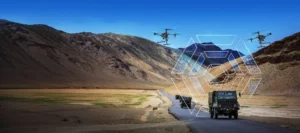
Garud Survey has emerged as a pioneer in this domain, leveraging state-of-the-art drones, LiDAR, and photogrammetry to deliver high-resolution, cost-effective, and rapid aerial surveys across the country.
Why Choose Aerial Surveying Over Traditional Methods?
1. Unmatched Speed & Efficiency
A single drone flight can cover hundreds of acres in hours, a task that would take weeks with ground surveys. This drastically reduces project timelines, making aerial surveys ideal for large-scale infrastructure and environmental monitoring.
2. Pinpoint Accuracy with Advanced Sensors
Equipped with LiDAR, multispectral cameras, and high-resolution RGB sensors, drones capture sub-centimeter accuracy data, essential for:
Topographic mapping
Volumetric calculations (mining, stockpiles)
Utility corridor inspections
Disaster risk assessment
3. Access to Inaccessible Terrains
From the Himalayan slopes to dense forests and coastal regions, drones effortlessly navigate areas where traditional survey teams face logistical and safety challenges.
4. Cost-Effective & Eco-Friendly
Aerial surveys reduce manpower, fuel costs, and equipment expenses while minimizing environmental disturbance—a sustainable choice for modern industries.
Garud Survey: Your Trusted Aerial Survey Partner in India
As one of India’s most trusted aerial survey companies, Garud Survey specializes in:
✔ High-Precision Drone Mapping
2D Orthomosaic & 3D Digital Terrain Models (DTM) for urban planning.
Contour mapping for construction and irrigation projects.
✔ LiDAR-Based Surveys
Power line inspections with vegetation encroachment analysis.
Floodplain mapping for disaster preparedness.
✔ Mining & Quarry Surveys
Stockpile volume measurement with 99% accuracy.
Slope stability monitoring to prevent accidents.
✔ Agricultural & Environmental Surveys
Crop health analysis using NDVI sensors.
Deforestation tracking for environmental compliance.
Case Study: How Garud Survey Helped a National Highway Project
A leading infrastructure firm needed 500 km of topographic mapping for a new highway in Rajasthan. Traditional methods would have taken 3+ months, but Garud Survey’s drone team completed the survey in 12 days, delivering:
1:500 scale accuracy maps
Identification of land erosion risks
Optimized route planning, saving ₹2.8 crore in realignment costs.
The Future of Aerial Surveying in India
With the Digital India and Smart Cities Mission driving demand for geospatial data, aerial surveys are becoming indispensable. Garud Survey is at the forefront of this shift, investing in:
AI-powered automated data processing
Beyond Visual Line of Sight (BVLOS) drone operations
Hyperspectral imaging for advanced analytics
Why Garud Survey Stands Out Among Aerial Survey Companies in India?
DGCA-certified pilots & compliant operations
Fleet of advanced drones (fixed-wing & multirotor)
Quick turnaround without compromising accuracy
Custom solutions for government & private sectors
Conclusion
In an era where data is the new oil, aerial surveying provides the fastest, safest, and most accurate way to harness geospatial intelligence. Garud Survey combines cutting-edge technology, regulatory expertise, and industry experience to deliver unmatched aerial survey solutions across India.
Ready to take your project to new heights? Contact Garud Survey—India’s premier aerial survey company—today!