Chennai is one of India’s rapidly developing metropolitan and industrial regions, with continuous growth in residential development, highways, railways, industrial corridors, ports, infrastructure, and urban expansion. As projects become larger and more complex, accurate and timely geospatial information is essential for effective planning and engineering.
This is where Drone Survey in Chennai and Aerial LiDAR Survey in Chennai & Tamil Nadu are transforming conventional land mapping. By combining UAV technology, LiDAR sensors, high-resolution cameras, GNSS/RTK positioning, photogrammetry, and GIS, modern aerial surveying can provide detailed information about terrain, structures, roads, vegetation, and other surface features.
At Garud Survey Private Limited, we provide professional drone surveying, LiDAR surveying, topographic mapping, 3D modelling, and geospatial solutions for infrastructure, construction, real estate, industrial, transportation, agriculture, mining, and environmental projects across Chennai and Tamil Nadu.
Why Drone Survey in Chennai is the Future of Land Mapping
Traditional land surveying remains valuable, but large project areas, difficult terrain, traffic, dense urban development, and demanding project schedules can make extensive ground-based data collection challenging.
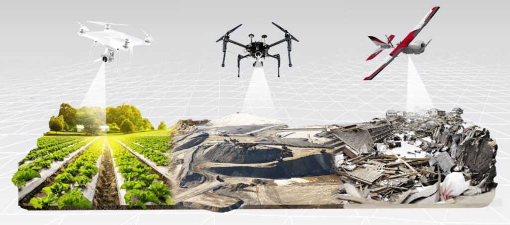
Drone Survey in Chennai offers an efficient aerial approach for collecting high-resolution spatial information. UAVs can capture extensive areas quickly and produce detailed datasets that can be processed into orthomosaic maps, topographic maps, 3D models, point clouds, Digital Elevation Models (DEM), and Digital Surface Models (DSM).
Key advantages include:
- High Accuracy: RTK/PPK-enabled UAV workflows can support high-precision mapping when properly planned and controlled.
- Rapid Data Collection: Large areas can be surveyed efficiently compared with extensive conventional field operations.
- Cost Efficiency: Reduced fieldwork can help optimize manpower and project resources.
- Improved Safety: Aerial data collection can reduce exposure to hazardous or difficult-to-access areas.
- Detailed Visualization: Orthomosaics, 3D models, point clouds, and elevation datasets provide a comprehensive view of project sites.
What is Aerial LiDAR Survey?
Aerial LiDAR Survey is an advanced remote-sensing method that uses laser pulses to measure distances between an aerial sensor and the ground or surface features. The collected measurements are processed into a dense 3D point cloud representing the surveyed environment.
LiDAR is particularly useful when detailed elevation and terrain information is required. Depending on project conditions and sensor configuration, LiDAR data can support terrain modelling even in areas where vegetation makes conventional optical mapping more difficult.
For infrastructure and engineering projects, Aerial LiDAR Survey in Chennai can be used to generate detailed terrain information for planning, design, analysis, and decision-making.
Aerial LiDAR Survey in Chennai & Tamil Nadu
Tamil Nadu has extensive requirements for infrastructure mapping, transportation development, industrial expansion, urban planning, coastal studies, and engineering projects. An Aerial LiDAR Survey in Tamil Nadu can provide high-density elevation and 3D spatial information across large and complex project areas.
Typical LiDAR deliverables may include:
- 3D LiDAR point clouds
- Digital Terrain Models (DTM)
- Digital Elevation Models (DEM)
- Digital Surface Models (DSM)
- Contour maps
- Elevation profiles
- Terrain classification
- 3D terrain models
- Road and corridor mapping
- Slope and elevation analysis
- GIS-ready spatial datasets
- CAD-compatible survey outputs
These datasets can be integrated into engineering, GIS, CAD, BIM, and infrastructure planning workflows according to project requirements.
How LiDAR and Drone Survey Work Together
Drone photogrammetry and LiDAR are complementary technologies rather than direct substitutes.
Drone photogrammetry is highly effective for capturing detailed visual information and producing orthomosaics, textured 3D models, and high-resolution imagery.
LiDAR surveying is particularly useful when dense elevation measurements, terrain modelling, corridor mapping, and 3D point-cloud information are required.
For complex projects, combining drone imagery with LiDAR data can provide both visual context and detailed elevation information, creating a more comprehensive digital representation of the project area.
Drone Survey and LiDAR Applications in Chennai
1. Topographic and Land Survey
Drone and LiDAR technology can capture terrain characteristics, elevation changes, contours, site features, and other spatial information required for planning and engineering.
2. Road and Highway Projects
For highway and road development, aerial surveying can support corridor mapping, terrain profiling, cross-section generation, alignment studies, earthwork calculations, and preliminary engineering analysis.
3. Railway and Metro Projects
Long transportation corridors can be surveyed efficiently using UAV and LiDAR technology. The resulting datasets can support route planning, terrain analysis, structure mapping, and engineering workflows.
4. Real Estate and Urban Development
Developers can use aerial mapping for site assessment, land development planning, construction monitoring, volumetric calculations, and 3D visualization.
5. Industrial Infrastructure
Industrial facilities and large development sites can benefit from detailed topographic mapping, progress monitoring, asset mapping, and 3D spatial documentation.
6. Coastal and Environmental Mapping
Chennai’s coastal environment creates requirements for shoreline monitoring, erosion studies, terrain assessment, flood-related analysis, and environmental mapping. Drone imagery and LiDAR can provide valuable spatial datasets for such applications.
7. Agriculture and Plantation Mapping
UAV surveys can support crop monitoring, field mapping, vegetation assessment, irrigation planning, and agricultural management.
8. Mining and Quarry Surveys
Drone and LiDAR surveys can be used for terrain modelling, stockpile measurement, volumetric calculations, excavation monitoring, and mine-site mapping.
Services Offered by Garud Survey Private Limited
Garud Survey provides a comprehensive range of aerial surveying and geospatial services in Chennai and Tamil Nadu, including:
- Drone Topographic Survey
- Aerial LiDAR Survey
- Drone Photogrammetry
- Land and Site Mapping
- 3D Mapping and Modelling
- Construction Progress Monitoring
- Orthomosaic Mapping
- Digital Elevation Model Generation
- Digital Terrain Model Generation
- Volumetric Survey
- Road and Highway Corridor Survey
- Mining and Quarry Survey
- Agricultural Drone Survey
- Infrastructure Inspection
- GIS Mapping and Spatial Data Processing
Our services can be customized according to project size, terrain, accuracy requirements, sensor selection, and final deliverables.
Benefits of Aerial LiDAR Survey in Tamil Nadu
Organizations looking for Aerial LiDAR Survey in Tamil Nadu can benefit from a data-rich approach to large-scale surveying.
High-Density 3D Data
LiDAR can collect millions of laser measurements, creating detailed three-dimensional point clouds for terrain and surface analysis.
Efficient Coverage
Aerial platforms can cover extensive areas efficiently, making LiDAR particularly useful for large infrastructure corridors and development sites.
Detailed Elevation Information
LiDAR-derived datasets can support DTM, DSM, DEM, contour, slope, and elevation-profile generation.
Support for Engineering Design
Accurate terrain information can help engineers and planners evaluate existing site conditions before detailed design and construction.
Reduced Field Exposure
Aerial data collection can reduce the need for personnel to work continuously in traffic zones, difficult terrain, construction sites, or other challenging environments.
Why Choose Garud Survey for Drone Survey in Chennai?
Garud Survey Private Limited combines UAV technology, surveying expertise, GIS capabilities, and advanced data processing to deliver project-focused aerial mapping solutions.
Advanced Survey Technology
We use modern UAV platforms, high-resolution imaging systems, GNSS/RTK workflows, and LiDAR technology where project requirements justify their use.
Experienced Professionals
Our multidisciplinary team includes surveying, GIS, engineering, and data-processing professionals who understand the technical requirements of infrastructure and mapping projects.
Customized Survey Solutions
Every project is different. Survey methodology, flight planning, control requirements, sensor selection, accuracy targets, and deliverables can be customized according to project specifications.
Detailed Data Deliverables
Depending on the project, clients can receive orthomosaics, point clouds, contours, DEM, DSM, DTM, 3D models, CAD/GIS datasets, and other required outputs.
End-to-End Support
From project planning and field data acquisition to processing, quality control, mapping, and final delivery, Garud Survey provides an integrated surveying workflow.
Industries We Serve in Chennai & Tamil Nadu
Our aerial survey and LiDAR solutions can support:
- Government and urban development projects
- Real estate and construction
- Roads and highways
- Railways and metro infrastructure
- Ports and industrial infrastructure
- Power and energy
- Mining and quarrying
- Agriculture and forestry
- Environmental projects
- Smart city and GIS initiatives
- Water and drainage infrastructure
Drone Survey vs Traditional Surveying
Drone surveying does not eliminate the need for professional ground surveying in every project. Instead, it provides an efficient complementary method for collecting large amounts of spatial data.
Traditional surveying can be highly effective for specific control, boundary, construction staking, and detailed ground measurements. Drone and LiDAR surveys are particularly advantageous for large-area mapping, terrain modelling, visual documentation, corridor surveys, and areas where extensive ground access is difficult.
A hybrid workflow combining ground control, GNSS surveying, drone photogrammetry, and LiDAR can often provide a comprehensive dataset for complex engineering projects.
Frequently Asked Questions
What is Drone Survey in Chennai?
Drone Survey in Chennai is the use of UAVs equipped with cameras and sensors to capture aerial imagery and spatial information for land mapping, topographic surveys, construction monitoring, infrastructure projects, and other applications.
What is Aerial LiDAR Survey in Chennai?
Aerial LiDAR Survey in Chennai uses laser-based remote sensing from an aerial platform to collect dense elevation and 3D spatial measurements. The data can be processed into point clouds, terrain models, contours, and other engineering datasets.
What is the difference between drone photogrammetry and LiDAR?
Photogrammetry primarily uses overlapping photographs to reconstruct spatial information, while LiDAR uses laser measurements to generate 3D point-cloud data. The best technology depends on the project’s terrain, accuracy requirements, environment, and required deliverables.
Can LiDAR be used for highway projects in Tamil Nadu?
Yes. LiDAR can be useful for highway corridor mapping, terrain profiling, alignment studies, elevation analysis, earthwork estimation, and other engineering applications, subject to project specifications.
Can drone surveys be used for construction monitoring?
Yes. Periodic drone surveys can provide aerial imagery and 3D datasets that help project teams monitor progress, compare site conditions over time, document construction activities, and support quantity calculations.
Which areas can Garud Survey cover?
Garud Survey Private Limited provides surveying and geospatial services across Chennai, Tamil Nadu, and other locations in India, depending on project requirements and operational feasibility.
Conclusion
The future of land mapping and infrastructure development is increasingly dependent on accurate, timely, and actionable spatial information. Drone Survey in Chennai provides an efficient way to capture high-resolution aerial data, while Aerial LiDAR Survey in Chennai & Tamil Nadu adds detailed elevation and three-dimensional information for demanding engineering and infrastructure applications.
From urban development and real estate to highways, railways, industrial projects, mining, agriculture, and environmental studies, modern aerial surveying can help organizations understand their sites more effectively and make informed project decisions.
Garud Survey Private Limited provides professional drone survey, LiDAR survey, topographic mapping, photogrammetry, 3D modelling, and GIS solutions tailored to project requirements.
If you are looking for Drone Survey in Chennai, Aerial LiDAR Survey in Chennai, or Aerial LiDAR Survey in Tamil Nadu, Garud Survey can help you develop a suitable aerial mapping and geospatial solution for your project.