In recent years, the role of drones in disaster management and emergency response has become increasingly vital. Drones, or Unmanned Aerial Vehicles (UAVs), have revolutionized how first responders and emergency personnel assess, manage, and mitigate the impact of disasters. These airborne devices are equipped with high-definition cameras, thermal sensors, and various other technologies, which enable them to provide real-time data, mapping, surveillance, and much more in disaster scenarios. Integrating drones into disaster management strategies is reshaping the approach to emergency response, saving lives, and enhancing the effectiveness of operations.
Real-Time Aerial Surveillance
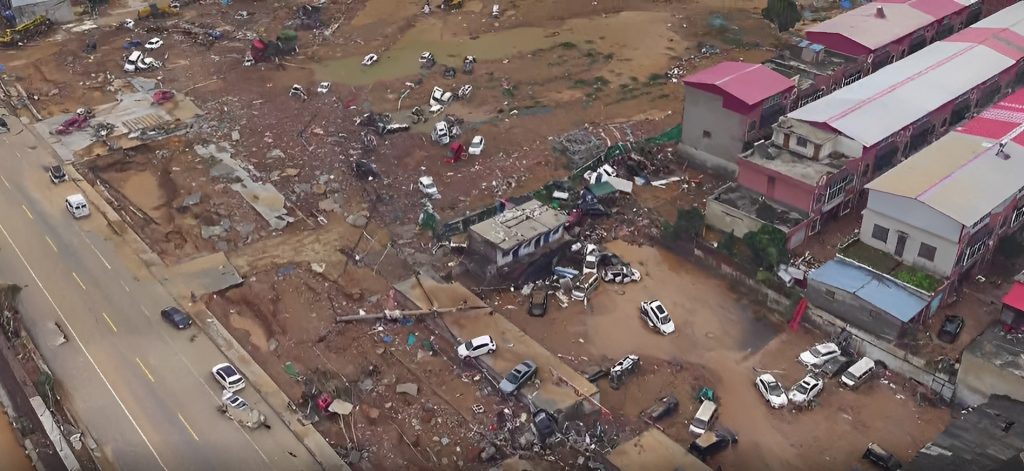
One of drones’ most significant contributions to disaster management is real-time aerial surveillance. During a disaster, access to affected areas can be restricted or dangerous for human responders. Drones can quickly and safely survey large areas, providing high-resolution imagery and video feeds. This aerial view helps emergency response teams better understand the disaster’s scope, locate survivors, identify hazards, and assess the damage.
For instance, in the aftermath of hurricanes, earthquakes, floods, or wildfires, drones can fly over inaccessible regions and transmit live footage. This immediate data allows authorities to prioritize rescue efforts, determine where to send resources and identify safe routes for emergency vehicles. Drones can also provide continuous monitoring of the situation, ensuring that responders are up-to-date with the changing conditions on the ground.
Search and Rescue Operations
Drones play a critical role in search and rescue operations, especially in situations where people are trapped or stranded in difficult-to-reach locations. Traditional methods of searching for survivors can be slow, and in many cases, hazardous. Drones equipped with thermal imaging cameras can detect heat signatures from survivors, even through debris or in areas with low visibility due to smoke, fog, or darkness.
For example, during the 2017 Mexico City earthquake, drones were used to search for trapped survivors in collapsed buildings. The use of drones enabled rescue teams to locate individuals quickly and safely, significantly improving the speed and efficiency of the operation. Drones’ ability to fly into narrow spaces and maneuver around obstacles allows them to cover areas that might otherwise be difficult for ground teams to access.
Damage Assessment and Mapping
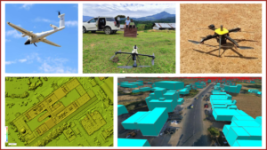
In disaster zones, understanding the extent of the damage is crucial for effective response and recovery. Drones equipped with LiDAR (Light Detection and Ranging) and photogrammetry tools can create highly accurate 3D maps of disaster areas, enabling detailed damage assessment. These maps help authorities assess infrastructure damage, such as destroyed buildings, bridges, and roads, and estimate the cost of repairs.
Furthermore, drones can map out flood zones, wildfire perimeters, and landslides, providing valuable information for resource allocation and long-term recovery planning. The ability to gather accurate, up-to-date data significantly improves the efficiency of the relief effort, ensuring that resources are distributed where they are needed most.
Delivery of Supplies
Drones also have the potential to deliver essential supplies, such as medicine, food, and water, to disaster-stricken areas. In remote or hard-to-reach locations, traditional delivery methods may be delayed or impossible. Drones can carry out deliveries to isolated communities, providing quick relief to those in need. In addition, drones can deliver medical supplies, including vaccines or defibrillators, to areas with limited access to healthcare facilities.
During the 2020 pandemic, drones were used to deliver COVID-19 test samples and medical supplies, showcasing their usefulness in a wide range of emergencies. Their ability to bypass traffic and transport critical items makes them invaluable during natural and man-made disasters.
Communication in Crisis
Communication is often disrupted during disasters, making it difficult for responders and affected populations to stay connected. Drones can assist by providing temporary communication networks. Some drones are equipped with communication relay systems that can establish networks in areas where traditional infrastructure is damaged or destroyed. These communication hubs ensure that rescue teams, relief agencies, and citizens can stay in touch, share information, and coordinate efforts effectively.
Challenges and Future Potential
While drones have proven to be valuable tools in disaster management, their deployment does come with challenges. Regulatory restrictions, technical limitations (such as battery life and payload capacity), and the need for specialized training for operators are some of the barriers that need to be addressed. However, ongoing advancements in drone technology, including longer battery life, increased automation, and improved AI capabilities, hold the potential to overcome these challenges.
In the future, drones could become even more integral to disaster management systems. With the development of autonomous drones, the ability to deploy large fleets of UAVs for real-time data collection, surveillance, and rescue operations could become a reality. This will make disaster response faster, more accurate, and more efficient, ultimately saving lives and reducing the overall impact of disasters.
Conclusion
Drones have undoubtedly revolutionized disaster management and emergency response. Their ability to provide real-time surveillance, support search and rescue missions, assess damage, deliver supplies, and maintain communication is reshaping how we respond to natural and man-made disasters. As technology continues to evolve, drones will play an even more pivotal role in helping emergency responders save lives, improve recovery efforts, and reduce the devastating impacts of disasters worldwide.


