Land surveying is a fundamental component of infrastructure development, providing the essential data and analysis required for the successful planning, design, construction, and maintenance of various structures such as roads, bridges, utilities, and buildings. Surveyors play a pivotal role in ensuring that infrastructure projects are executed with precision, adhere to legal standards, and align with environmental considerations.
Site Assessment and Preliminary Planning
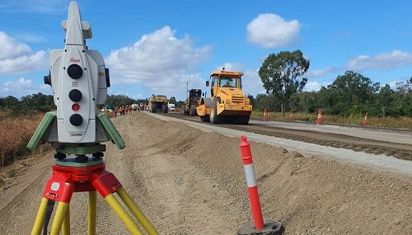
Before the commencement of any infrastructure project, a comprehensive site assessment is conducted by land surveyors. This initial phase involves collecting critical data regarding the project’s location, including topographical features, geological conditions, and environmental factors. Such detailed information is indispensable for engineers and designers to evaluate the feasibility of the project, optimize its layout, and ensure compliance with regulatory requirements. For instance, understanding the land’s topography aids in identifying suitable locations for constructing roads, railways, and buildings, as well as in planning drainage systems to prevent flooding.
Accurate Geospatial Data Collection
Land surveyors employ advanced technologies, including Global Navigation Satellite Systems (GNSS), LiDAR, and drones, to gather precise geospatial data. This high level of accuracy is crucial for the correct placement of infrastructure components, minimizing errors, and reducing the need for costly revisions during construction. The integration of accurate survey data into digital models facilitates effective collaboration among project stakeholders, streamlining project management and coordination.
Establishing Boundaries and Legal Compliance
A key responsibility of land surveyors is to define property boundaries and ensure that infrastructure projects comply with legal standards. By accurately determining land ownership lines, surveyors help prevent disputes and legal challenges that could delay or derail projects. This process involves creating detailed cadastral maps that delineate property boundaries and identify existing easements or rights-of-way. Such clarity is essential for securing permits, negotiating land acquisitions, and maintaining good relationships with property owners and the community.
Utility Mapping and Conflict Prevention
Prior to excavation and construction, identifying the precise location of existing utilities—such as water pipes, gas lines, and electrical cables—is critical. Land surveyors utilize specialized equipment to create accurate utility maps, which are essential for preventing accidental damage during construction. This proactive approach safeguards public safety, avoids service disruptions, and reduces the risk of costly repairs.
Construction Layout and Quality Assurance
During the construction phase, surveyors play a vital role in translating design plans into physical reality. They establish reference points and markers that guide the placement of foundations, roads, and other infrastructure elements, ensuring that construction aligns precisely with design specifications. Continuous monitoring and verification by surveyors during construction help identify and address any deviations from the plan, maintaining the project’s integrity and quality. Environmental and Safety Considerations
Land surveyors contribute to environmental stewardship by assessing and documenting the impact of proposed infrastructure on natural resources. They identify features such as wetlands, floodplains, and habitats of endangered species, providing data that inform design modifications aimed at minimizing environmental harm. Additionally, by ensuring that infrastructure is built on stable ground and adheres to safety regulations, surveyors help prevent accidents and disasters, thereby protecting public welfare.
Supporting Urban Planning and Sustainable Development
In urban settings, land surveyors assist in optimizing land use by providing accurate data that inform zoning decisions, transportation planning, and the development of public spaces. Their work supports sustainable development by ensuring that infrastructure projects are well-integrated into the existing urban fabric, enhance accessibility, and contribute positively to the community’s quality of life.
Conclusion
Land surveying is an indispensable discipline in infrastructure development, offering precise measurements, legal clarity, and environmental insights that underpin the successful execution of construction projects. By providing accurate data and ensuring compliance with legal and safety standards, land surveyors facilitate the creation of infrastructure that is safe, efficient, and beneficial to society. Their expertise not only supports the technical aspects of construction but also contributes to the broader goals of sustainable and harmonious development.