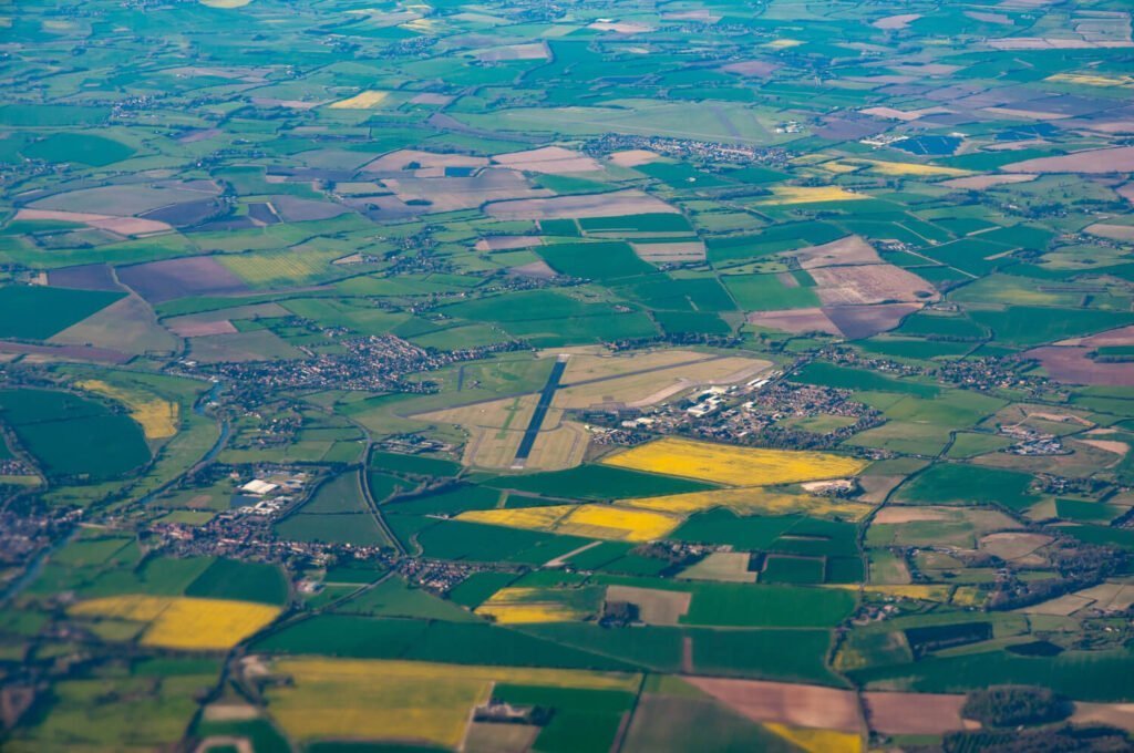
Lucknow, the City of Nawabs, is rapidly transforming into a modern urban hub. With ongoing infrastructure projects, real estate expansion, and smart city initiatives, the demand for accurate and efficient land mapping solutions has never been higher. This is where drone survey in Lucknow is making a revolutionary impact. Combining innovation, precision, and speed, drone surveys are redefining how data is collected and utilized for development projects.
At Garud Survey Private Limited, we specialize in providing professional drone surveying and mapping services that cater to government agencies, construction firms, real estate developers, and agricultural sectors across Lucknow and India.
What is a Drone Survey?
A drone survey uses unmanned aerial vehicles (UAVs) equipped with high-resolution cameras and advanced sensors to capture detailed aerial imagery and spatial data. This data is then processed into 2D maps, 3D models, and topographic maps, providing engineers, planners, and decision-makers with highly accurate insights.
Compared to traditional ground-based surveys, drone surveys are faster, safer, and more cost-effective, making them the preferred choice for modern infrastructure and mapping projects.
Why Drone Survey is Essential in Lucknow
Lucknow’s landscape is rapidly changing due to new roadways, metro projects, and housing developments. Manual surveys struggle to keep up with this pace, often leading to delays and inaccuracies. Drone surveys offer a modern alternative by providing real-time, high-resolution aerial data that supports faster planning and execution.
Key reasons why drone survey in Lucknow is becoming essential include:
Smart City and Urban Development: Helps government agencies monitor urban growth and plan efficient layouts.
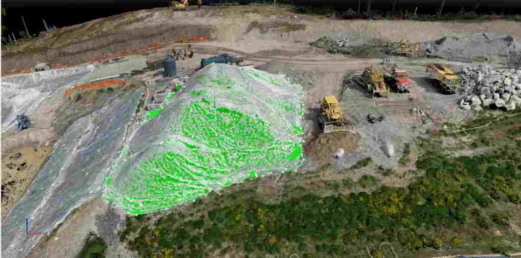
Construction and Real Estate: Enables accurate site mapping, volume measurement, and project progress monitoring.
Agriculture and Land Management: Assists in crop health monitoring, land classification, and irrigation planning.
Infrastructure Inspection: Perfect for assessing bridges, roads, and transmission lines without human risk.
Environmental and River Mapping: Useful for analyzing flood-prone areas and monitoring environmental changes.
Advantages of Choosing Garud Survey Private Limited
At Garud Survey Private Limited, we deliver comprehensive drone survey services in Lucknow with advanced UAVs and experienced professionals. Our team ensures that every survey is conducted safely, legally, and efficiently under DGCA (Directorate General of Civil Aviation) guidelines.
Here’s what makes us the preferred drone survey company in Lucknow:
Unmatched Accuracy – We deliver centimeter-level precision with high-quality aerial data.
Fast Data Collection – Complete surveys in hours instead of days, saving time and resources.
Detailed Reporting – Our clients receive easy-to-read maps, 3D terrain models, and digital elevation data.
Cost Efficiency – Get accurate results at affordable rates compared to traditional land surveys.
Expert Support – Our team includes certified pilots and GIS professionals who ensure top-quality results.
Industries We Serve
Garud Survey Private Limited provides drone surveying and mapping solutions for multiple sectors in Lucknow, including:
Real Estate and Construction
Mining and Quarrying
Agriculture and Forestry
Infrastructure and Road Development
Power and Energy Projects
Environmental Monitoring and Flood Mapping
Our customized drone solutions help clients across these industries make informed, data-driven decisions.
Why Choose Drone Survey in Lucknow by Garud Survey Private Limited
We combine cutting-edge drone technology with years of expertise to deliver accurate and actionable data for every project. Whether you are a real estate developer, a construction firm, or a government body, our drone survey in Lucknow service ensures precise mapping and faster project execution.
Our commitment lies in providing safe, compliant, and high-quality aerial data solutions that support Lucknow’s growth and modernization.
Conclusion
The future of land mapping and infrastructure development lies in drone technology. As Lucknow continues to expand, adopting drone surveys can help organizations save time, cut costs, and improve accuracy across every stage of their projects.
With Garud Survey Private Limited, you gain a trusted partner dedicated to transforming your vision into reality through the power of advanced aerial mapping and intelligent drone solutions.