India, with its vast and varied landscape, faces unique challenges in infrastructure development, agriculture, mining, and environmental conservation. Traditional surveying methods, while effective, often fall short in terms of efficiency, accuracy, and safety. Enter drone surveys—a transformative technology that is revolutionizing data collection and analysis across numerous sectors. The benefits of drone surveys are manifold, offering unprecedented advantages that are propelling industries into a new era of innovation and productivity.
What is a Drone Survey?
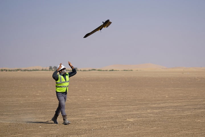
A drone survey utilizes unmanned aerial vehicles (UAVs) equipped with high-resolution cameras, LiDAR sensors, and other advanced technologies to capture aerial data. This data is then processed to create detailed maps, 3D models, and various analytical insights. In India, the adoption of drone surveys is growing rapidly, driven by the need for more efficient, accurate, and safe surveying methods.
Benefits of Drone Surveys in India
1. Enhanced Accuracy and Precision
Drone surveys provide a level of accuracy and precision that is difficult to achieve with traditional methods. High-resolution cameras and advanced sensors capture detailed aerial imagery, which can be processed into precise maps and models. This accuracy is crucial for applications such as land surveying, infrastructure planning, and environmental monitoring, ensuring that decisions are based on reliable data.
2. Time and Cost Efficiency
Traditional surveying methods are often time-consuming and labor-intensive. Drone surveys, on the other hand, can cover large areas quickly and efficiently, reducing the time required for data collection. This not only speeds up project timelines but also significantly lowers labor costs. For industries like construction and agriculture, where timely data is critical, drone surveys offer a valuable advantage.
3. Improved Safety
Surveying can be hazardous, especially in industries like mining and construction, where workers are exposed to dangerous conditions. Drones mitigate these risks by allowing surveys to be conducted remotely. This means that workers no longer need to enter potentially dangerous areas, reducing the likelihood of accidents and enhancing overall safety.
4. Accessibility to Difficult Terrain
India’s diverse terrain includes everything from dense forests and mountainous regions to vast agricultural fields and urban landscapes. Traditional surveying methods can struggle in such varied environments. Drones, however, can easily navigate and capture data in challenging terrains, making them an ideal solution for surveying hard-to-reach areas.
5. Real-Time Data and Monitoring
One of the most significant advantages of drone surveys is the ability to provide real-time data and monitoring. This capability is invaluable for applications such as construction progress tracking, disaster management, and environmental monitoring. Real-time data allows for immediate analysis and decision-making, ensuring that projects stay on track and any issues are promptly addressed.
6. Versatility and Adaptability
Drones are incredibly versatile and can be equipped with various sensors and cameras to suit different surveying needs. Whether it’s thermal imaging for agricultural assessments, LiDAR for topographic mapping, or multispectral imaging for environmental studies, drones can be adapted to provide the specific data required for a wide range of applications.
Applications of Drone Surveys in India
1. Agriculture
Agriculture is a cornerstone of India’s economy, and drone surveys are playing a pivotal role in modernizing the sector. Drones are used for crop monitoring, soil analysis, and assessing irrigation systems. By providing precise data on crop health and growth patterns, drones help farmers make informed decisions, optimize resource use, and improve yields.
2. Infrastructure and Construction
In infrastructure development, drone surveys are used for site planning, progress monitoring, and quality control. High-resolution aerial imagery and 3D models aid in the accurate planning and execution of construction projects. Drones also enable regular monitoring of construction sites, ensuring that projects stay on schedule and meet safety standards.
3. Mining
Mining is another industry where drone surveys offer significant benefits. Drones can conduct aerial surveys of mining sites, providing detailed topographic data and helping with resource estimation. They also improve safety by allowing remote inspection of hazardous areas, reducing the need for personnel to enter potentially dangerous environments.
4. Environmental Conservation
Environmental conservation efforts drone survey benefits. Drones are used to monitor wildlife, assess forest health, and track changes in ecosystems. They provide valuable data for environmental impact assessments and help in the management and protection of natural resources.
5. Urban Planning and Development
In urban planning, drone surveys offer precise data for land use analysis, infrastructure development, and zoning. They help planners visualize and assess the impact of proposed developments, ensuring that urban growth is sustainable and well-managed.
Challenges and the Future of Drone Surveys in India
While the benefits of drone surveys are clear, there are challenges to their widespread adoption in India. Regulatory hurdles, privacy concerns, and the need for skilled operators are some of the barriers that need to be addressed. However, with the government’s push towards digitalization and technological innovation, these challenges are gradually being overcome.
The future of drone surveys in India looks promising. As technology evolves, drones will become even more capable and accessible. Integration with artificial intelligence and machine learning will enhance their data processing and analysis capabilities, providing deeper insights and predictive analytics for various industries.
Conclusion
Drone surveys are transforming the way data is collected and analyzed in India. Their benefits—ranging from enhanced accuracy and efficiency to improved safety and real-time monitoring—are driving innovation and productivity across multiple sectors. As the technology matures and regulatory frameworks adapt, the adoption of drone surveys is set to accelerate, unlocking new opportunities for growth and development in India.
By embracing drone technology, India can address its unique challenges and leverage its diverse landscape to achieve greater efficiency, sustainability, and progress in the years to come.