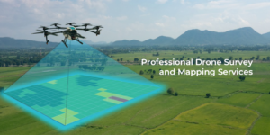
Introduction
In recent years, LiDAR (Light Detection and Ranging) Survey in India has gained significant traction due to its precision and efficiency in land mapping, urban planning, and infrastructure development. As a cutting-edge remote sensing technology, LiDAR provides high-resolution 3D data, making it indispensable for various industries. Garud Survey, a leading surveying company in India, leverages advanced LiDAR technology to deliver accurate and reliable geospatial solutions for government and private projects.
What is LiDAR Survey?
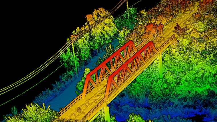
LiDAR is a remote sensing method that uses laser pulses to measure distances and generate precise 3D representations of the Earth’s surface. Unlike traditional surveying techniques, LiDAR can penetrate dense vegetation and capture minute topographical details, making it ideal for:
Topographic Mapping
Forestry and Environmental Studies
Urban Planning & Smart City Projects
Transportation & Highway Design
Disaster Management & Flood Modeling
Why is LiDAR Survey Gaining Popularity in India?
India is undergoing rapid urbanization and infrastructure expansion, increasing the demand for high-precision land surveys. Here’s why LiDAR is becoming the preferred choice:
1. Unmatched Accuracy
LiDAR provides centimeter-level accuracy, essential for large-scale projects like highways, railways, and smart city developments.
2. Faster Data Collection
Traditional surveys take weeks or months, whereas LiDAR surveys can cover vast areas in days, reducing project timelines.
3. Cost-Effective in the Long Run
Though the initial investment is higher, LiDAR reduces fieldwork costs and minimizes errors, saving money on rework.
4. Versatility in Applications
From mining surveys to archaeological site mapping, LiDAR’s adaptability makes it valuable across sectors.
Garud Survey: Leading the Way in LiDAR Surveying in India
Garud Survey is at the forefront of geospatial innovation, offering state-of-the-art LiDAR survey services in India. Our expertise includes:
Aerial LiDAR Surveys (using drones & aircraft)
Terrestrial LiDAR Scanning (for ground-based projects)
Bathymetric LiDAR (for underwater terrain mapping)
GIS Integration & Data Processing
We serve industries such as construction, agriculture, defense, and environmental monitoring, ensuring compliance with Indian surveying standards.
Key Projects Enabled by LiDAR in India
Smart City Missions – LiDAR helps in urban planning, drainage design, and utility mapping.
Highway & Expressway Development – Ensures accurate terrain modeling for better road alignment.
Forest Conservation – Used for canopy height measurement and biodiversity assessment.
Flood Risk Assessment – Helps in predicting flood-prone zones for better disaster preparedness.
Future of LiDAR Survey in India
With the Indian government pushing for digital infrastructure and sustainable development, LiDAR technology will play a crucial role in:
Land Records Modernization
Renewable Energy Projects (Solar/Wind Farm Planning)
Railway & Metro Network Expansion
Garud Survey remains committed to adopting the latest advancements in LiDAR to support India’s growth.
Conclusion
The adoption of LiDAR Survey in India is transforming how land mapping and infrastructure projects are executed. With its speed, accuracy, and versatility, LiDAR is set to become the backbone of geospatial surveys in the coming years. Garud Survey is proud to be a trusted partner in this technological revolution, providing top-tier LiDAR solutions tailored to India’s unique challenges.
For high-precision LiDAR surveying services, contact Garud Survey today and elevate your project’s efficiency and accuracy!