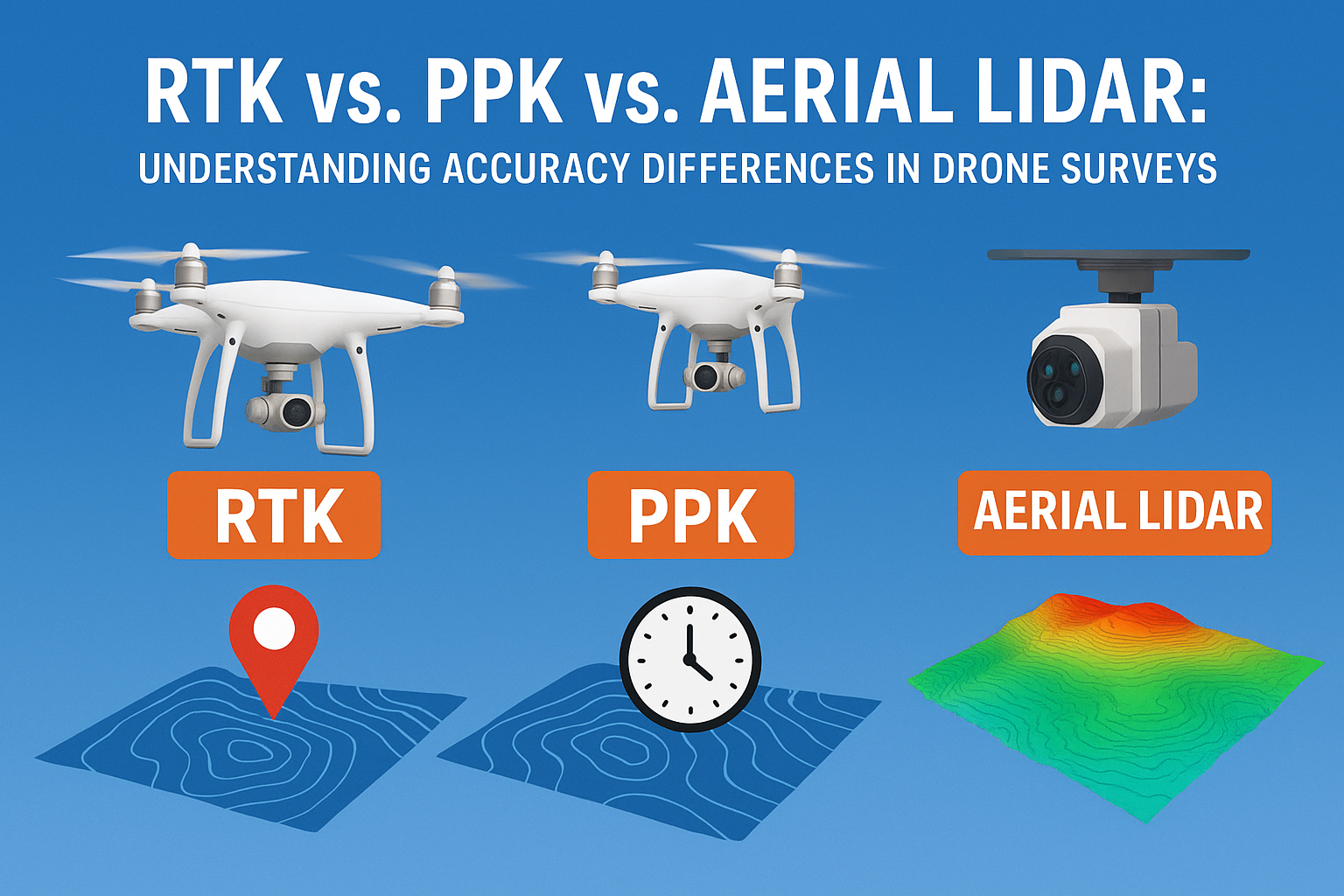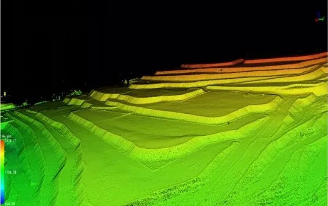
Drone-Based LiDAR Surveys: A Game Changer for Detailed Project Reports
In today’s fast-paced infrastructure, mining, and urban development sectors, accurate data is the foundation of successful planning and execution. Traditional surveying methods often struggle to deliver high-precision data within tight…