Seismic Refraction Tomography
Seismic Refraction Tomography
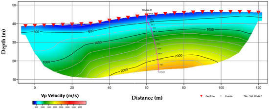
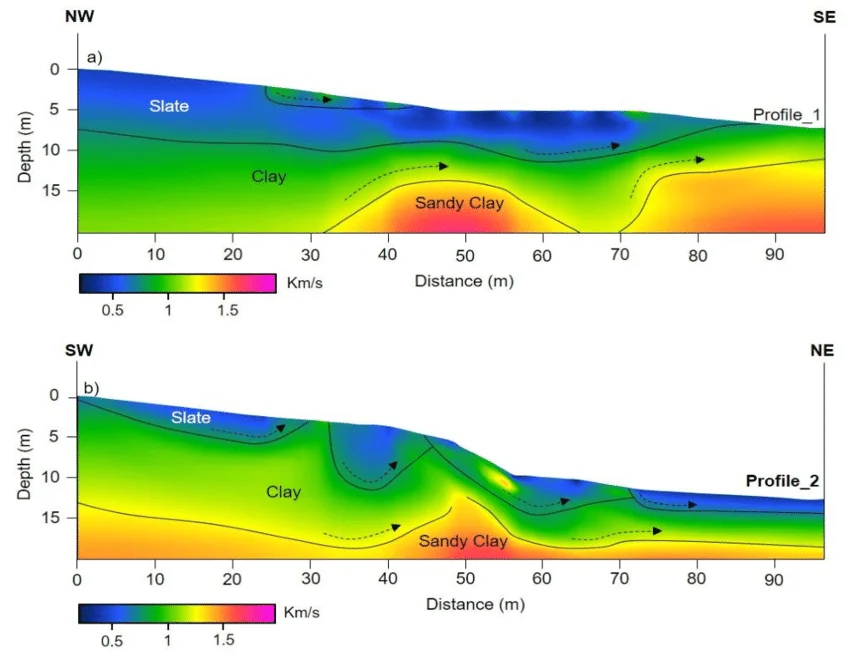
Garud Survey Private Limited offers advanced Seismic Refraction Tomography (SRT) services for accurate subsurface imaging. Using cutting-edge technology, we map soil and rock layers to identify geological variations, groundwater potential, and engineering risks. Our precise, reliable data supports construction, mining, and infrastructure projects across India, ensuring smarter planning and safer execution.
- Detailed 2D/3D subsurface velocity models for accurate geological profiling
- Identification of layer boundaries, bedrock depth, and weak zones
- High-resolution imaging of subsurface structures and stratigraphy
- Processed seismic data with inversion results and interpretation
- Comprehensive report including cross-sections, maps, and engineering insights
Survey Methodology
We offer advanced Seismic Refraction Tomography Survey Methodology to deliver accurate subsurface insights. Our process involves controlled seismic wave generation, precise data acquisition, and high-resolution imaging to map soil and rock layers. This technique ensures reliable depth profiling for construction, mining, and infrastructure projects, enabling informed decisions with cost-effective and efficient geophysical solutions.