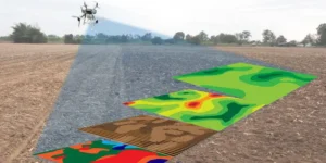
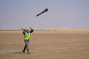
In recent years, drone surveying has emerged as a transformative force in land mapping across India. Leveraging advanced drone technology, this approach is enhancing accuracy, efficiency, and accessibility in land records, particularly in rural areas. The government’s Svamitva Yojana, launched in 2021, exemplifies this shift, aiming to provide rural residents with clear property rights and facilitate financial inclusion.
The Rise of Drone-Based Land Mapping
Traditional land surveying methods in India often involve manual measurements and extensive paperwork, leading to delays and inaccuracies. Drones equipped with high-resolution cameras and GPS systems can rapidly capture detailed aerial imagery, creating precise digital maps of land parcels. This technology significantly reduces human error and the time required for surveys, making it particularly beneficial in densely populated or remote areas.
Svamitva Yojana: A Landmark Initiative
The Svamitva Yojana (Survey of Villages Abadi and Mapping with Improvised Technology in Village Areas) is a central government scheme aimed at mapping rural residential areas using drone technology. Launched in 2021, the initiative seeks to provide rural residents with property cards, thereby clarifying property rights and reducing disputes. As of December 2024, the scheme had surveyed over 310,000 villages, digitized nearly 100 million land parcels, and distributed more than 1.12 crore property cards .
Enhancing Financial Inclusion
One of the primary objectives of the Svamitva Yojana is to facilitate financial inclusion. By providing residents with official property documents, individuals can use their land as collateral to access formal credit systems. This is particularly advantageous for small farmers and rural entrepreneurs who previously lacked recognized ownership titles, enabling them to secure loans for agricultural development, business expansion, or personal needs.
Supporting Sustainable Development
Beyond financial benefits, drone surveying contributes to sustainable development by enabling more effective land use planning. Accurate land maps assist in the implementation of infrastructure projects, environmental conservation efforts, and disaster management strategies. For instance, precise mapping helps in identifying flood-prone areas, planning drainage systems, and monitoring land degradation, thereby promoting ecological balance and resilience.
Addressing Challenges and Concerns
Despite its advantages, the integration of drone technology in land surveying raises several challenges. Issues related to data privacy, the digital divide, and the potential for misuse of information are significant concerns. There is a need for robust data protection laws and regulations to ensure that the collected geospatial data is used ethically and transparently. Moreover, efforts must be made to ensure that marginalized communities have access to and benefit from these technological advancements .
Conclusion
Drone surveying is undeniably revolutionizing land mapping in India, offering a modern solution to age-old challenges in land administration. Through initiatives like the Svamitva Yojana, the country is making significant strides toward equitable land rights, enhanced financial inclusion, and sustainable development. However, to fully realize the potential of this technology, it is imperative to address the associated challenges with comprehensive policies and inclusive practices.


