In the realm of geophysical exploration, the integration of cutting-edge technology has been nothing short of revolutionary. One such innovation, the utilization of drone magnetic survey, has emerged as a transformative tool in mapping subsurface structures and uncovering valuable insights about the Earth’s composition. This breakthrough technology is reshaping the landscape of geophysical exploration, offering unparalleled precision, efficiency, and cost-effectiveness.
Traditional methods of geophysical exploration have long relied on ground-based surveys and airborne techniques using helicopters or fixed-wing aircraft equipped with magnetometers. While these methods have been effective, they often come with limitations in terms of accessibility, accuracy, and cost.
The Basics of Drone Magnetic Survey
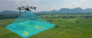
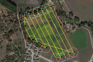
At its core, a drone magnetic survey involves the use of unmanned aerial vehicles (UAVs) equipped with highly sensitive magnetometers to measure and map variations in the Earth’s magnetic field. These variations are indicative of subsurface geological features, making it an invaluable tool for mineral exploration, archaeological studies, and environmental assessments.
Unleashing Precision and Efficiency
Traditional ground-based magnetic surveys have been the go-to method for decades, but they come with limitations. Accessibility to certain terrains, time-consuming data collection, and the risk of missing critical details are among the challenges faced by geophysicists. Enter drone magnetic surveys, and these challenges are met head-on.
Drones effortlessly navigate challenging terrains, including dense forests, mountainous regions, and bodies of water, providing access to areas that were once difficult or impossible to reach. The flexibility of drone deployment ensures a comprehensive and accurate data collection process, minimizing the risk of oversights in the exploration phase.
Reducing Environmental Impact
Environmental consciousness is at the forefront of modern scientific practices, and drone magnetic surveys align seamlessly with this ethos. Compared to traditional ground-based methods that may involve clearing vegetation or disrupting ecosystems, drones leave a minimal footprint. The reduced environmental impact not only complies with ethical exploration practices but also opens avenues for research in delicate or protected areas.
Enhancing Safety Measures
Geophysical exploration often involves venturing into remote and hazardous locations, exposing fieldworkers to various risks. Drone survey services alleviate these safety concerns by taking on the brunt of the data collection process. This not only reduces the risk to human life but also allows experts to focus on data interpretation and analysis, refining the accuracy of geological assessments.
Unraveling Hidden Resources
One of the primary applications of drone magnetic surveys is in mineral exploration. By detecting variations in the Earth’s magnetic field, drones can identify subsurface structures associated with mineral deposits. This has the potential to revolutionize the mining industry by streamlining exploration efforts and significantly reducing costs.
The ability to pinpoint potential resource-rich areas with greater precision enables mining companies to make informed decisions about where to allocate resources for further exploration and extraction. This not only optimizes the use of resources but also minimizes the environmental impact associated with exploratory activities.
Archaeological Discoveries from Above
Beyond resource exploration, drone magnetic surveys have proven instrumental in archaeological research. The technology’s ability to detect subtle variations in magnetic fields helps archaeologists identify buried structures, artifacts, and ancient features that may be invisible to the naked eye.
For example, in a recent archaeological project, a drone magnetic survey revealed the presence of an ancient city buried beneath layers of sediment. The survey not only provided a detailed map of the city’s layout but also offered insights into the historical timeline of the site. This discovery would have been significantly delayed or overlooked using traditional survey methods.
Challenges and Future Prospects
While the benefits of drone magnetic surveys are evident, challenges such as data processing and interpretation complexities, as well as regulatory concerns, must be addressed. Researchers and industry professionals are actively working on refining algorithms for efficient data analysis and interpretation.
Looking ahead, the integration of artificial intelligence (AI) and machine learning (ML) in the data processing pipeline holds great promise. These technologies can enhance the speed and accuracy of data interpretation, further unlocking the potential of drone magnetic surveys in geophysical exploration.
Conclusion
In conclusion, the advent of drone magnetic surveys marks a paradigm shift in geophysical exploration. The technology’s ability to provide precise, efficient, and environmentally friendly data collection is reshaping how we uncover the Earth’s secrets. From mineral exploration to archaeological discoveries, the applications of drone magnetic surveys are vast and far-reaching. As we continue to unlock the power of this game-changing technology, the future of geophysical exploration looks more promising than ever.


