The construction industry is no stranger to innovation, and the integration of drone technology has proven to be a transformative force. Drone surveys are revolutionizing construction planning and project management, offering unprecedented levels of accuracy, efficiency, and cost-effectiveness. By leveraging aerial data collection and advanced analytics, construction companies can streamline operations, reduce risks, and deliver projects on time and within budget. This blog explores the benefits of drone surveys in construction planning and how they are reshaping project management.
The Role of Drone Surveys in Construction Planning
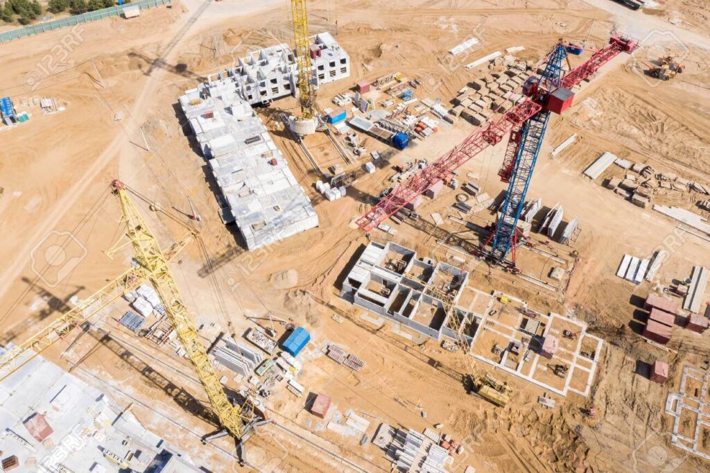
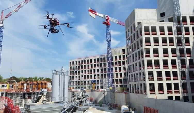
Drone surveys involve the use of unmanned aerial vehicles (UAVs) equipped with high-resolution cameras, LiDAR sensors, and GPS technology to capture detailed aerial imagery and topographic data. This data is then processed to create 2D maps, 3D models, and digital terrain models (DTMs) that provide valuable insights for construction planning. Here’s how drone surveys are enhancing the process:
- Accurate Site Analysis
Before any construction project begins, a thorough understanding of the site is essential. Drone surveys provide highly accurate topographic data, enabling project managers to assess the terrain, identify potential challenges, and plan accordingly. This level of precision minimizes errors and ensures that designs are tailored to the site’s unique characteristics. - Improved Design and Visualization
Drones capture high-resolution images and create detailed 3D models of the construction site. These models allow architects, engineers, and stakeholders to visualize the project in its entirety, making it easier to identify design flaws, optimize layouts, and make informed decisions. - Efficient Resource Allocation
By providing real-time data on site conditions, drone surveys help project managers allocate resources more effectively. Whether it’s materials, equipment, or labor, having accurate information ensures that resources are used efficiently, reducing waste and lowering costs.
Benefits of Drone Surveys for Project Management
The integration of drone surveys into construction planning offers numerous benefits for project management, including:
- Time Savings
Traditional land surveys can take days or even weeks to complete, depending on the size and complexity of the site. Drones can cover large areas in a fraction of the time, significantly speeding up the surveying process. This allows project managers to move forward with planning and execution more quickly. - Cost Reduction
Drone surveys are more cost-effective than traditional methods. They require fewer personnel, less equipment, and minimal site disruption. Additionally, the ability to identify potential issues early in the planning phase helps avoid costly delays and rework during construction. - Enhanced Safety
Construction sites can be hazardous, with uneven terrain, heavy machinery, and potential structural risks. Drone surveys eliminate the need for personnel to physically access dangerous areas, reducing the risk of accidents and injuries. - Real-Time Monitoring and Progress Tracking
Drones enable project managers to monitor construction progress in real-time. Regular aerial surveys provide up-to-date information on site conditions, allowing managers to track progress, identify bottlenecks, and make adjustments as needed. This ensures that projects stay on schedule and within budget. - Improved Communication and Collaboration
The detailed maps and 3D models generated by drone surveys serve as valuable tools for communication and collaboration. Project stakeholders can easily share and review data, ensuring that everyone is on the same page. This transparency fosters better decision-making and reduces the likelihood of misunderstandings. - Environmental Impact Assessment
Drones can be used to monitor the environmental impact of construction activities, such as soil erosion, vegetation loss, and water runoff. This information helps project managers implement sustainable practices and comply with environmental regulations.
Case Study: Drone Surveys in Action
Consider a large-scale infrastructure project, such as the construction of a highway or bridge. Traditional surveying methods would require significant time and resources to map the entire site. With drone surveys, the same area can be mapped in a matter of hours. The resulting data provides a comprehensive overview of the site, including elevation changes, drainage patterns, and potential obstacles. This information is invaluable for designing the project, planning construction phases, and ensuring that the final structure is built to specifications.
The Future of Construction Planning with Drones
As drone technology continues to advance, its applications in construction planning will only grow. Future developments may include:
- Autonomous Drones: Drones that can operate without human intervention, further reducing labor costs and increasing efficiency.
- AI-Powered Analytics: Advanced algorithms that analyze drone data to predict potential issues and recommend solutions.
- Integration with BIM: Seamless integration of drone data with Building Information Modeling (BIM) systems for enhanced project management.
Conclusion
Drone surveys are transforming construction planning and project management, offering a host of benefits that improve accuracy, efficiency, and safety. By providing detailed, real-time data, drones enable project managers to make informed decisions, optimize resources, and deliver projects successfully. As the construction industry continues to embrace this technology, drone surveys will become an indispensable tool for achieving better outcomes and driving innovation. Companies that adopt drone technology today will be well-positioned to lead the industry tomorrow.