LiDAR vs Photogrammetry: What is the Real Difference?
When creating a topographic map for highways, railways, transmission lines, solar parks, mining projects, industrial developments, or urban infrastructure projects, both LiDAR and Photogrammetry can generate terrain data. However, the biggest difference is that Photogrammetry creates maps using overlapping aerial photographs, while LiDAR uses laser pulses to directly measure the ground surface.
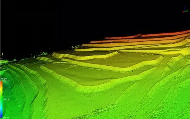
From an accuracy perspective, drone photogrammetry typically achieves up to 5 cm accuracy in the X and Y coordinates, while the vertical (Z-axis) accuracy generally ranges between 20–35 cm depending on terrain, vegetation, flight parameters, and ground control quality. In contrast, modern LiDAR systems can achieve up to 5 cm accuracy in X, Y, and Z coordinates, making them significantly more reliable for generating precise Digital Terrain Models (DTM) and engineering-grade topographic maps.
This difference becomes critical in infrastructure projects where accurate elevation data directly impacts earthwork calculations, drainage design, transmission tower spotting, railway gradients, highway design, and cut-and-fill estimations. If your primary objective is creating a surface map in open terrain, Photogrammetry may be a cost-effective option. However, where high vertical accuracy (Z-axis accuracy) is essential, LiDAR is often the preferred technology.
⸻
Understanding the Difference Between LiDAR and Photogrammetry
Photogrammetry Survey
Photogrammetry uses high-resolution drone imagery captured from multiple angles. Specialized software processes these overlapping photographs to create:
* Orthomosaic Maps
* Digital Surface Models (DSM)
* Contour Maps
* 3D Surface Models
* Topographic Maps
Photogrammetry performs exceptionally well in:
* Open land surveys
* Solar power projects
* Industrial layouts
* Urban planning projects
* Stockpile volume calculations
* Land development projects
Since the technology relies on visible imagery, dense vegetation can limit its ability to accurately capture the actual ground surface.
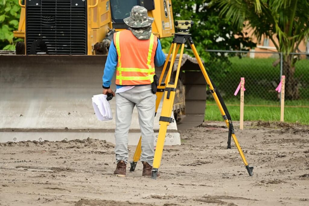
LiDAR Survey
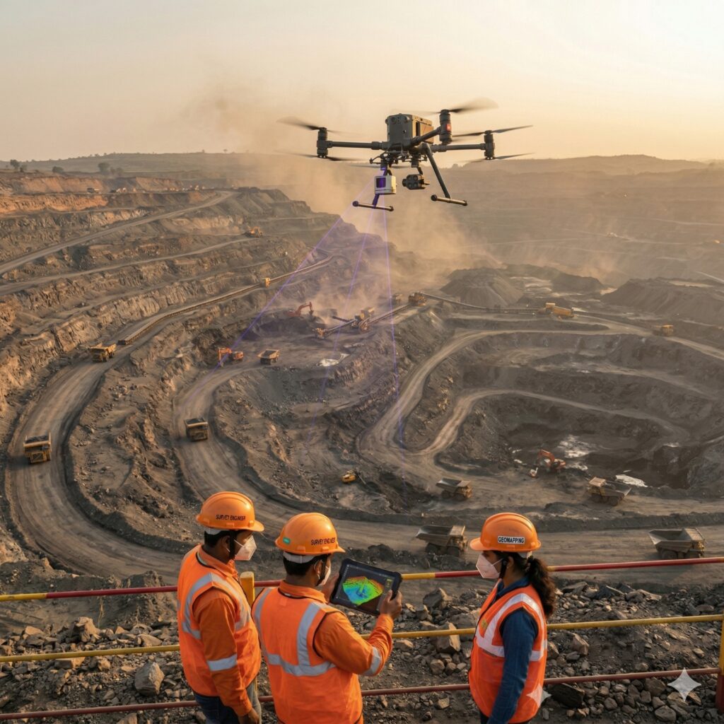
LiDAR (Light Detection and Ranging) uses laser pulses instead of photographs.
A LiDAR sensor emits thousands of laser pulses every second toward the ground and measures their return time to generate highly accurate three-dimensional terrain information.
LiDAR is particularly effective for:
* Highway corridor surveys
* Railway alignment projects
* Transmission line route surveys
* Forested areas
* Hilly terrain mapping
* Mining projects
* Large infrastructure developments
Because laser pulses can penetrate gaps in vegetation and reach the ground surface, LiDAR generates more accurate Digital Terrain Models compared to conventional photogrammetry.
Which Technology Should You Choose?
Choose Photogrammetry When:
* The survey area is mostly open land.
* Budget is a primary concern.
* Orthomosaic mapping is required.
* General topographic information is sufficient.
* Solar projects or industrial layouts are being planned.
Choose LiDAR When:
* Accurate ground levels are critical.
* Dense vegetation is present.
* Highway, railway, or transmission line corridors are involved.
* Precise earthwork calculations are required.
* Engineering design depends heavily on elevation accuracy.
* Large-scale infrastructure development is planned.
For projects where vertical accuracy directly affects design and construction decisions, LiDAR usually provides a significant advantage.
⸻
Why Infrastructure Consultants Prefer LiDAR for Major Projects
Highway consultants, DPR consultants, railway engineers, EPC contractors, and transmission line developers increasingly prefer LiDAR because it offers:
* Superior terrain modeling
* Accurate Digital Terrain Models (DTM)
* Better route optimization
* Reliable cut-and-fill calculations
* Improved drainage analysis
* Faster project execution
* Reduced design revisions
* Better decision-making during planning
The improved Z-axis accuracy often translates into substantial savings during construction and earthwork execution.
⸻
Why Choose Garud Survey Private Limited?
Garud Survey Private Limited provides both Drone LiDAR Surveys and Drone Photogrammetry Surveys across India.
Our team helps clients select the most suitable technology based on:
* Project objectives
* Terrain conditions
* Vegetation density
* Accuracy requirements
* Budget considerations
* Engineering deliverables
Our services include:
* LiDAR Survey
* Drone Topographic Survey
* Photogrammetry Survey
* Corridor Mapping
* DTM & DSM Generation
* Contour Mapping
* Highway Surveys
* Railway Alignment Surveys
* Transmission Line Surveys
* GIS Mapping Services
⸻
Conclusion
Both LiDAR and Photogrammetry are powerful topographic survey technologies, but they are designed for different project requirements.
If the objective is to generate mapping outputs for open terrain at a lower cost, Photogrammetry is often an excellent choice. However, when accurate ground elevations, high Z-axis accuracy, vegetation penetration, and engineering-grade terrain models are required, LiDAR clearly offers a significant advantage.
For highways, railways, transmission lines, mining projects, and large infrastructure developments where elevation accuracy directly impacts design and construction decisions, LiDAR is typically the preferred solution.
Choosing the right technology at the planning stage can significantly improve project efficiency, reduce design risks, and optimize overall project costs