India’s infrastructure landscape is evolving rapidly, with highways, railways, mining projects, smart cities, transmission corridors, industrial developments, and renewable energy projects requiring accurate geospatial information. Traditional surveying methods can become challenging when projects cover large, complex, or difficult-to-access areas. This is where LiDAR technology provides a powerful solution.
Garud Survey Private Limited is a professional LiDAR Survey Company in India providing advanced aerial and terrestrial surveying solutions for projects that require precise elevation data, detailed terrain mapping, and reliable 3D spatial information.
What Is a LiDAR Survey?
LiDAR stands for Light Detection and Ranging. It is a remote sensing technology that uses laser pulses to measure distances between a sensor and objects or surfaces.
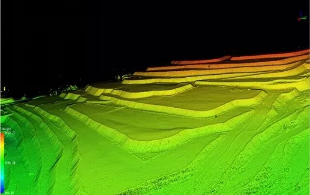
During a LiDAR survey, thousands or even millions of laser pulses can be collected across a project area. The captured information is processed to create a highly detailed 3D point cloud, digital elevation models, digital terrain models, contours, and other geospatial deliverables.
LiDAR can capture terrain characteristics even across areas where conventional optical surveying may be difficult. This makes it particularly valuable for large infrastructure and engineering projects.
Why Choose a LiDAR Survey Company in India?
Selecting an experienced LiDAR surveying partner can make a significant difference in project planning and execution. A professional survey company combines suitable sensors, positioning systems, flight planning, field control, data processing, and quality assurance.
Garud Survey Private Limited focuses on delivering survey data that can support engineering decisions, feasibility studies, design, construction planning, asset management, and monitoring.
The key advantages of professional LiDAR surveying include:
- High-density 3D spatial data
- Detailed terrain and elevation information
- Efficient coverage of large project areas
- Reduced dependency on extensive ground measurements
- Digital terrain and elevation modelling
- Accurate contour generation
- Identification of terrain features and infrastructure
- Data suitable for GIS and engineering workflows
- Faster surveying of challenging locations
Applications of LiDAR Surveying in India
LiDAR technology has applications across numerous industries. Some of the major sectors that can benefit from LiDAR surveying include:
1. Highway and Road Projects
Highway development requires reliable information about existing ground conditions, road corridors, drainage, structures, and surrounding terrain. LiDAR surveys can support corridor mapping, topographic analysis, design preparation, and construction planning.
For large road projects, LiDAR can help survey extensive alignments efficiently while generating detailed elevation information.
2. Rail and Metro Projects
Railway and metro infrastructure often requires accurate corridor information. LiDAR data can be used for terrain modelling, alignment studies, vegetation assessment, infrastructure mapping, and planning around existing assets.
3. Mining Surveys
Mining operations require regular measurement of terrain, stockpiles, excavation areas, haul roads, and other mine features. LiDAR surveying can generate detailed 3D models that support volumetric calculations, mine planning, progress monitoring, and terrain analysis.
4. Power Transmission Corridors
Transmission line projects involve long corridors and complex terrain. LiDAR surveys can help map the corridor, identify vegetation and terrain conditions, and support infrastructure planning and asset management.
5. Urban and Smart City Mapping
Urban areas contain buildings, roads, utilities, drainage systems, vegetation, and other complex features. LiDAR can help generate detailed 3D spatial datasets for urban planning, infrastructure management, GIS development, and smart city applications.
6. Solar and Renewable Energy Projects
Before developing a large solar project, accurate information about terrain and elevation is essential. LiDAR surveying can support site assessment, terrain modelling, drainage studies, grading analysis, and project planning.
LiDAR Survey Deliverables
Depending on project requirements, a professional LiDAR survey may provide multiple types of outputs. These can include:
- Classified LiDAR point clouds
- 3D point cloud datasets
- Digital Elevation Models (DEM)
- Digital Terrain Models (DTM)
- Digital Surface Models (DSM)
- Contour maps
- Orthomosaic integration
- 3D terrain models
- CAD-compatible survey information
- GIS-ready spatial datasets
- Cross-sections and profiles
- Elevation and corridor information
The final deliverables can be customized according to engineering, GIS, planning, or asset-management requirements.
LiDAR Survey Process
A successful LiDAR project involves more than simply collecting laser data. A structured workflow helps ensure useful and reliable results.
Project Planning
The survey team first evaluates the project area, required accuracy, terrain, deliverables, and technical objectives.
Data Acquisition
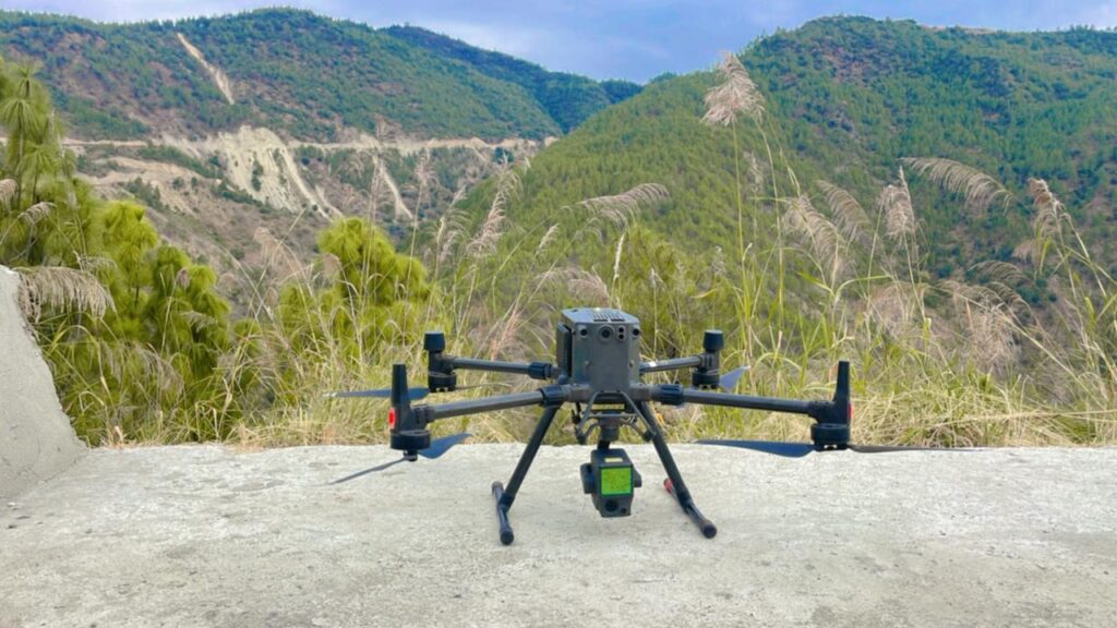
LiDAR sensors can be deployed using suitable aerial platforms or other survey configurations depending on project requirements.
Ground Control and Positioning
GNSS, IMU, and ground control information can be integrated into the survey workflow to support accurate positioning and georeferencing.
Data Processing
Raw LiDAR observations are processed to generate a structured point cloud. Classification and filtering can then separate terrain, vegetation, buildings, and other relevant features.
Quality Control
Survey data is checked against project specifications and control information before final delivery.
Final Mapping and Modelling
The processed information can be converted into maps, models, contours, profiles, and other required engineering or GIS outputs.
LiDAR vs Traditional Surveying
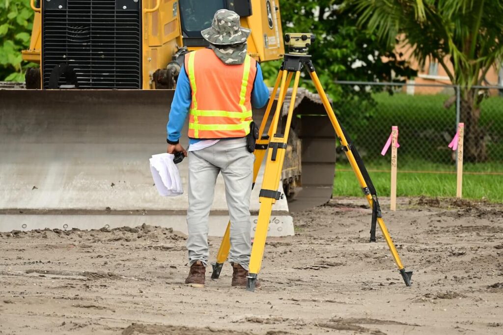
Traditional total station and GNSS surveying remain highly useful for many applications. However, large-area projects can require considerable field effort when using only conventional techniques.
LiDAR complements traditional surveying by enabling rapid collection of dense spatial information over broad areas. Instead of relying exclusively on individual measured points, LiDAR can create a detailed three-dimensional representation of the surveyed environment.
For many modern projects, combining LiDAR with GNSS control, photogrammetry, GIS, and conventional surveying can provide a more comprehensive geospatial workflow.
Why Garud Survey Private Limited?
Garud Survey Private Limited provides technology-driven surveying and geospatial solutions for infrastructure, mining, urban development, energy, transportation, and other industries.
As a LiDAR Survey Company in India, our approach focuses on understanding the project’s technical requirements before selecting the appropriate survey methodology and deliverables.
Our capabilities can support:
- Large-area topographic mapping
- Corridor surveys
- 3D terrain modelling
- Infrastructure mapping
- Mining applications
- Urban mapping
- Power corridor surveys
- Renewable energy site assessment
- GIS and geospatial data generation
- Engineering survey support
The objective is to provide reliable spatial information that helps project teams make informed decisions.
The Future of LiDAR Surveying in India
As India’s infrastructure projects become larger and more technology-driven, demand for high-quality geospatial data is expected to increase. LiDAR is well positioned to support this transformation because it can produce detailed three-dimensional information for complex environments.
Integration with drones, artificial intelligence, GIS, cloud-based processing, digital twins, and other geospatial technologies is further expanding the potential of LiDAR surveying.
For project developers, consultants, engineers, government agencies, EPC companies, and infrastructure contractors, adopting advanced surveying technologies can improve the way spatial information is collected, analysed, and utilized.
Conclusion
LiDAR surveying has become an important technology for modern mapping and infrastructure development. From highways and railways to mining, power corridors, smart cities, and renewable energy projects, detailed 3D geospatial information can provide valuable support throughout the project lifecycle.
If you are searching for a reliable LiDAR Survey Company in India, Garud Survey Private Limited can provide technology-driven surveying and mapping solutions tailored to your project’s requirements.
Frequently Asked Questions
1. What is a LiDAR survey?
A LiDAR survey uses laser pulses to measure distances and generate detailed three-dimensional information about terrain, structures, vegetation, and other surfaces.
2. What is a LiDAR survey used for?
LiDAR surveys are used for topographic mapping, corridor surveys, highway projects, railway planning, mining, power transmission, urban mapping, renewable energy projects, and 3D modelling.
3. Is LiDAR suitable for large infrastructure projects?
Yes. LiDAR is particularly useful for large or complex areas where detailed elevation and three-dimensional spatial information are required.
4. What deliverables can be generated from LiDAR data?
Depending on project requirements, deliverables may include point clouds, DEM, DTM, DSM, contours, 3D models, profiles, and GIS-ready datasets.
5. Why hire a professional LiDAR Survey Company in India?
An experienced survey company can manage mission planning, data acquisition, positioning, processing, classification, quality control, and final mapping according to project requirements.
6. Can LiDAR be used for highway surveys?
Yes. LiDAR can support highway corridor mapping, terrain modelling, elevation analysis, drainage assessment, design support, and construction monitoring.
7. Does Garud Survey Private Limited provide LiDAR surveying services?
Yes. Garud Survey Private Limited provides LiDAR and advanced geospatial surveying solutions for infrastructure and other project applications across India.
8. How do I select the right LiDAR survey provider?
Consider technical expertise, surveying equipment, data-processing capabilities, quality-control procedures, experience with similar projects, and the ability to provide the required GIS or engineering deliverables.