India’s highway infrastructure is expanding rapidly, creating a growing need for accurate, efficient, and technology-driven surveying solutions. From greenfield expressways and national highways to widening, bypass, and rehabilitation projects, engineers need reliable terrain data before making critical design decisions. Aerial LiDAR Survey for Highway Alignment & Engineering Design provides a modern solution by capturing high-density three-dimensional information across extensive road corridors.
Garud Survey Private Limited uses advanced surveying and geospatial technologies to support infrastructure projects with accurate mapping, terrain modelling, and engineering data. A LiDAR Survey for Highway projects can help consultants, EPC contractors, infrastructure developers, and government agencies improve planning, reduce field constraints, and build a detailed digital representation of the project corridor.
What Is Aerial LiDAR Survey for Highway Projects?
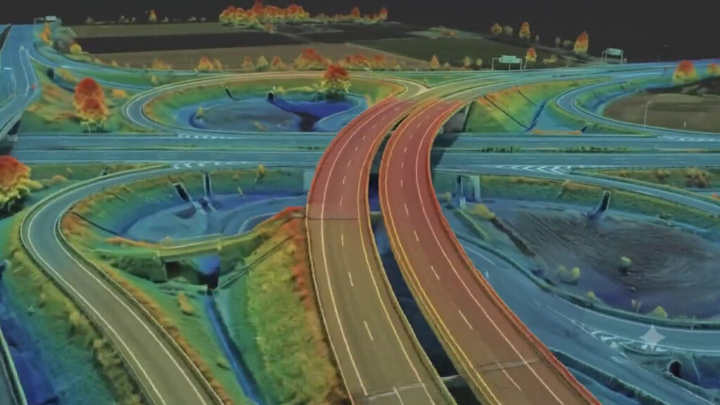
Aerial LiDAR, or Light Detection and Ranging, is a remote-sensing technology that uses laser pulses to measure the distance between a sensor and objects or terrain below. When mounted on an aircraft, helicopter, or suitable UAV platform, LiDAR can collect millions of measurements across a large corridor.
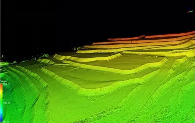
These measurements are processed into a three-dimensional point cloud. Further classification and modelling can produce Digital Terrain Models (DTM), Digital Elevation Models (DEM), contours, profiles, cross-sections, and other engineering datasets.
For highway development, this information can provide engineers with a detailed understanding of existing terrain before alignment and engineering design decisions are finalised.
Why LiDAR Survey for Highway Alignment Is Important
Highway alignment directly influences construction cost, land requirements, safety, drainage, earthwork, and long-term road performance. Selecting an appropriate alignment requires detailed information about terrain, existing infrastructure, settlements, water bodies, vegetation, slopes, and other corridor characteristics.
A LiDAR Survey for Highway alignment can provide dense elevation data that helps engineering teams analyse:
- Existing ground levels
- Terrain slopes and elevation changes
- Potential cut-and-fill zones
- Natural drainage patterns
- Embankments and depressions
- River and stream crossings
- Existing roads and infrastructure
- Roadside features
- Possible alignment constraints
Instead of relying on isolated ground measurements alone, project teams can work with a continuous digital representation of the corridor.
Role of LiDAR Survey for NHAI Projects
Large national highway projects often cover extensive distances and pass through diverse geographical conditions. LiDAR Survey for NHAI applications can support the preparation and evaluation of detailed spatial information required during different stages of highway development.
LiDAR can be useful for greenfield highway corridors, highway widening, expressways, bypasses, interchanges, service roads, and rehabilitation projects.
For NHAI-related work, project-specific technical specifications, accuracy requirements, control procedures, and deliverables should always be established before survey execution. A professional survey workflow can then be designed around the project’s engineering and mapping requirements.
How Highway LiDAR Survey Supports Engineering Design
1. Detailed Topographic Mapping
A Highway LiDAR Survey can generate detailed terrain information across the project corridor. Engineers can use the resulting data to understand ground conditions and prepare topographic datasets for subsequent design activities.
2. Road Alignment Analysis
Accurate elevation data can assist engineers in evaluating alternative highway alignments. Terrain constraints, slopes, valleys, ridges, settlements, and existing infrastructure can be analysed within a common spatial environment.
3. Earthwork Estimation
Highway construction involves significant excavation and embankment work. A reliable terrain model can support cut-and-fill calculations and preliminary volume estimation, helping project teams understand the scale of earthwork required.
4. Cross-Section and Longitudinal Profile Generation
LiDAR-derived terrain models can be used to generate longitudinal profiles and cross-sections at required intervals. These datasets can support road geometry evaluation and engineering design workflows.
5. Drainage Planning
Water accumulation and natural drainage are important considerations in highway engineering. LiDAR elevation data can help identify low points, slopes, flow paths, catchment characteristics, and terrain depressions that may influence drainage design.
6. Bridge and Culvert Assessment
Highway corridors frequently cross rivers, streams, canals, and drainage channels. Detailed terrain information around these locations can support preliminary assessment and planning for bridges and culverts.
7. Slope and Terrain Analysis
In hilly and mountainous regions, understanding slope conditions is essential. LiDAR can provide detailed terrain information for analysing elevation variations, steep slopes, embankments, and potentially challenging sections of a proposed corridor.
Advantages of Aerial LiDAR Survey
Aerial LiDAR provides several advantages for large highway projects.
Large-area coverage: Long corridors can be surveyed efficiently compared with relying entirely on conventional point-by-point field measurements.
Dense spatial information: LiDAR produces high-density point-cloud data, allowing detailed terrain and feature analysis.
Three-dimensional mapping: Unlike simple two-dimensional mapping, LiDAR provides elevation information that can be incorporated into 3D models.
Reduced field limitations: Remote data acquisition can reduce the amount of time survey teams need to spend in traffic-heavy, difficult, or inaccessible locations.
Better project visualization: 3D terrain models can make it easier for engineers and stakeholders to understand existing site conditions.
Integration with engineering software: Properly processed LiDAR data can be integrated into GIS, CAD, BIM, and other digital engineering environments.
Aerial LiDAR vs Conventional Highway Survey
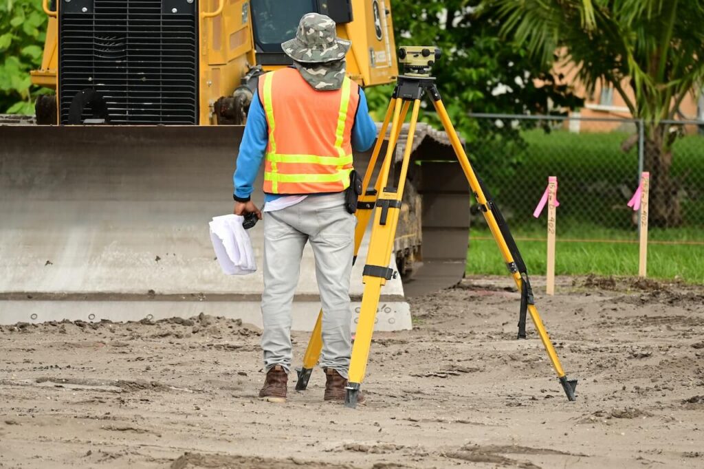
Conventional surveying methods such as GNSS, total stations, and ground-based measurements remain essential for many engineering applications. However, large highway corridors can present challenges when only traditional field methods are used.
A modern highway survey can combine LiDAR with GNSS control, total station observations, drone photogrammetry, GIS, and other technologies. This hybrid approach can provide both extensive corridor coverage and targeted high-accuracy ground verification.
The objective is not necessarily to replace conventional surveying, but to use the right technology for each project requirement.
LiDAR Survey Workflow for Highway Engineering
A professional LiDAR project generally follows a structured workflow:
Project Planning
The survey corridor, required accuracy, coordinate system, terrain conditions, flight parameters, control requirements, and final deliverables are defined.
Data Acquisition
The LiDAR sensor captures laser returns while GNSS and inertial measurement systems record the platform’s position and orientation.
Ground Control and Verification
Appropriate control and check points may be established or observed to support georeferencing and quality assessment.
Point-Cloud Processing
Raw data is processed, aligned, georeferenced, filtered, and classified into ground and non-ground points.
Terrain Modelling
The classified data can be used to generate DTMs, DEMs, contours, profiles, cross-sections, and 3D representations.
Engineering Deliverables
Final datasets are prepared according to project requirements and can be supplied in suitable GIS, CAD, point-cloud, raster, or other formats.
Why Choose Garud Survey Private Limited?
Garud Survey Private Limited provides modern surveying and geospatial solutions for infrastructure and engineering applications. For highway projects, combining LiDAR technology with drone surveying, GNSS, GIS, photogrammetry, and professional data processing can create a comprehensive spatial information workflow.
Before starting any project, clients should evaluate the survey provider’s technical capabilities, equipment, processing expertise, quality-control procedures, relevant project experience, and ability to deliver engineering-compatible outputs.
Future of Highway LiDAR Surveying
The future of Highway LiDAR Survey is closely connected with digital infrastructure. AI-assisted point-cloud classification, automated feature extraction, GIS integration, BIM, digital twins, and change-detection technologies can make LiDAR datasets even more valuable.
As highway projects become increasingly data-driven, detailed three-dimensional corridor information can support better collaboration between surveyors, designers, consultants, contractors, and project authorities.
Conclusion
Aerial LiDAR Survey for Highway Alignment & Engineering Design offers an efficient approach to capturing detailed three-dimensional terrain information across extensive road corridors. From alignment assessment and topographic mapping to earthwork estimation, drainage planning, slope analysis, and engineering design, LiDAR can support multiple phases of highway development.
For LiDAR Survey for Highway and LiDAR Survey for NHAI requirements, the combination of advanced aerial data acquisition, accurate positioning, professional point-cloud processing, and engineering-focused deliverables can provide valuable information for infrastructure decision-making.
Garud Survey Private Limited delivers technology-driven surveying and geospatial solutions designed to help modern infrastructure projects transform complex terrain data into practical engineering information.
Frequently Asked Questions (FAQs)
1. What is Aerial LiDAR Survey for highway alignment?
Aerial LiDAR Survey uses laser-based remote sensing to capture detailed elevation and three-dimensional information along a highway corridor. The data can support route assessment, alignment studies, terrain modelling, and engineering design.
2. How does LiDAR help highway engineering design?
LiDAR provides detailed elevation and terrain data that can support topographic mapping, profiles, cross-sections, earthwork analysis, drainage studies, slope assessment, and other engineering workflows.
3. What is LiDAR Survey for NHAI used for?
LiDAR Survey for NHAI projects can be used for corridor mapping, alignment assessment, topographic surveys, highway widening, terrain analysis, construction monitoring, and other project-specific surveying requirements.
4. What are the main deliverables of a Highway LiDAR Survey?
Typical deliverables may include classified point clouds, DTM, DEM, contours, digital terrain models, longitudinal profiles, cross-sections, 3D models, and GIS/CAD-compatible datasets, depending on project specifications.
5. Can LiDAR be used for greenfield highway projects?
Yes. LiDAR can provide detailed corridor information during the planning and feasibility stages of greenfield highway projects and can support subsequent alignment and engineering analysis.
6. Is LiDAR better than conventional surveying for highways?
LiDAR is highly effective for large-area and corridor mapping, while conventional GNSS and total station surveying remain important for control, verification, and specific detailed measurements. Combining technologies can provide a comprehensive survey solution.
7. Why is LiDAR useful for highway alignment?
LiDAR provides dense elevation information that helps engineers understand terrain, slopes, drainage patterns, and physical constraints, allowing alternative alignment options to be evaluated using detailed spatial data.
8. Why choose Garud Survey Private Limited for Highway LiDAR Survey?
Garud Survey Private Limited offers advanced surveying and geospatial capabilities, including LiDAR, drone surveying, GIS, photogrammetry, and terrain mapping, to support infrastructure and engineering projects.