If you’re planning a highway, railway, transmission line, mining, or infrastructure project, one of the first questions that comes to mind is:
“What is the LiDAR survey cost per kilometer in India?”
In 2026, LiDAR survey costs in India typically vary based on project length, corridor width, terrain conditions, vegetation density, accuracy requirements, and final deliverables. While there is no fixed nationwide rate, understanding the key cost drivers can help project owners and consultants prepare realistic budgets.
In this guide, we break down the factors affecting LiDAR survey pricing and explain the expected costs for highway, railway, transmission line, mining, and corridor mapping projects across India.
⸻
LiDAR Survey Cost Per Kilometer in India (Indicative Pricing)
The following table provides a general indication of LiDAR survey pricing in India. Actual costs may vary depending on project specifications and site conditions.
| Survey Type | Indicative Cost Range |
|---|---|
| Drone LiDAR Corridor Survey | ₹8,000 – ₹25,000 per km |
| Highway LiDAR Survey | ₹10,000 – ₹30,000 per km |
| Railway Corridor Survey | ₹12,000 – ₹35,000 per km |
| Transmission Line LiDAR Survey | ₹15,000 – ₹40,000 per km |
| Mining & Industrial LiDAR Survey | Project-specific pricing |
Note: These figures are indicative estimates only. Final pricing depends on project requirements, mobilization costs, permissions, survey width, and engineering deliverables.
⸻
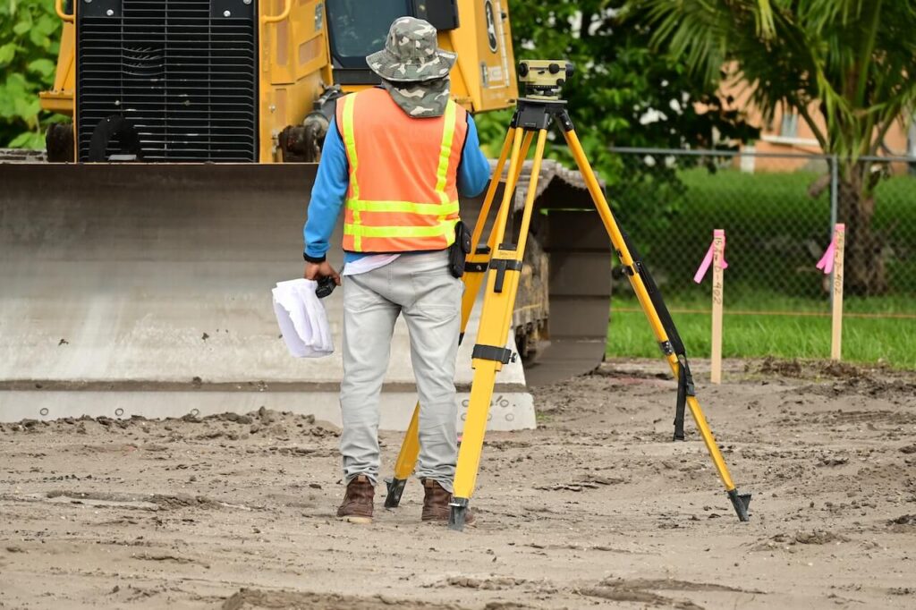
What is a LiDAR Survey?
LiDAR (Light Detection and Ranging) is an advanced remote sensing technology that uses laser pulses to measure distances between a sensor and the Earth’s surface.
Mounted on drones, aircraft, vehicles, or helicopters, LiDAR systems capture millions of data points and generate:
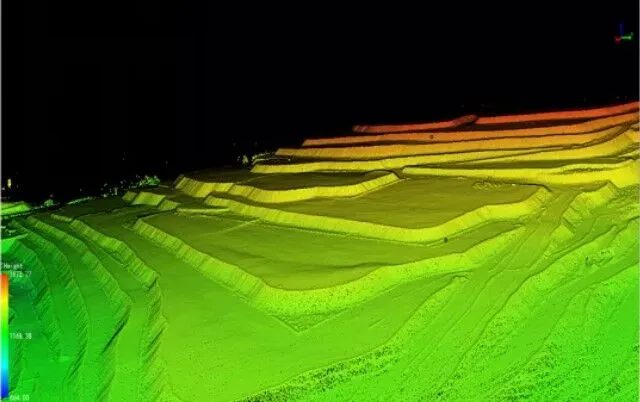
* High-resolution topographic maps
* Digital Elevation Models (DEM)
* Digital Surface Models (DSM)
* Contour maps
* 3D terrain models
* Point cloud datasets
LiDAR surveys are widely used for:
* Highway and road projects
* Railway corridor mapping
* Transmission line surveys
* Mining surveys
* Urban planning
* Flood modeling
* Industrial development
* Environmental studies
⸻
What Factors Affect LiDAR Survey Cost?
The cost of a LiDAR survey is influenced by multiple technical and operational factors.
1. Corridor Length
Longer projects generally benefit from economies of scale. A 200 km survey may have a lower per-kilometer cost than a 20 km survey because mobilization expenses are distributed across a larger area.
2. Corridor Width
A 50-meter corridor requires less data acquisition than a 300-meter-wide corridor. Wider corridors increase flight time, processing effort, and data volume.
3. Terrain Complexity
Surveying mountainous terrain, deep valleys, rocky areas, or inaccessible locations requires additional planning and operational effort.
4. Vegetation Density
Dense forests often require higher point density and advanced processing to extract accurate ground models, increasing project costs.
5. Accuracy Requirements
Engineering-grade projects requiring centimeter-level accuracy typically involve additional Ground Control Points (GCPs), validation, and quality checks.
6. Deliverables Required
Costs vary depending on whether the client requires:
* Point Cloud Data
* DEM
* DSM
* Contour Maps
* Cross Sections
* Longitudinal Profiles
* GIS Layers
* CAD Deliverables
7. Project Location
Remote areas may involve higher logistics, mobilization, accommodation, and transportation expenses.
⸻
Drone LiDAR Survey Cost in India
Drone LiDAR has become one of the most cost-effective methods for medium-scale infrastructure and engineering projects.
Common Applications
* Road alignments
* Industrial corridors
* Mining surveys
* River mapping
* Urban infrastructure projects
* Renewable energy projects
Benefits of Drone LiDAR
* Faster data collection
* Reduced field manpower
* High accuracy
* Access to difficult terrain
* Faster project completion
For many projects, Drone LiDAR can significantly reduce both survey time and long-term engineering costs.
⸻
Highway LiDAR Survey Cost
India’s rapidly expanding highway network has increased demand for high-precision geospatial data.
Highway LiDAR surveys support:
* Alignment planning
* Terrain analysis
* Cross sections
* Utility mapping
* Drainage studies
* Bridge and structure planning
Typical Cost Drivers
* Highway length
* Survey width
* Traffic management requirements
* Data density requirements
* Engineering deliverables
For large highway projects, LiDAR often reduces design revisions and minimizes rework during execution.
⸻
Railway LiDAR Survey Cost
Railway projects require accurate corridor mapping for modernization, expansion, and new alignment planning.
LiDAR Data Supports
* Existing track mapping
* Terrain analysis
* Utility crossings
* Drainage studies
* Alignment design
* Infrastructure assessment
Cost Influencing Factors
* Total corridor length
* Survey width
* Access permissions
* Operational restrictions
* Required engineering outputs
LiDAR has become one of the preferred technologies for long-distance railway corridor mapping due to its speed and efficiency.
⸻
Transmission Line LiDAR Survey Cost
Transmission line surveys are among the fastest-growing applications of LiDAR technology.
Common Deliverables
* Route optimization
* Tower spotting
* Clearance analysis
* Vegetation assessment
* Sag and tension studies
Pricing Factors
* Route length
* Forest cover
* Terrain conditions
* Regulatory approvals
* Required engineering deliverables
Drone-based LiDAR surveys are increasingly being adopted for transmission line projects because they reduce field risks while improving route planning accuracy.