Ground Water Survey for Borewell and Tubewell: Precision Water Exploration with Garud Survey
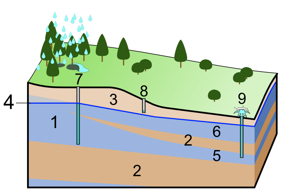
Access to clean and sustainable groundwater is critical for agriculture, industries, and domestic use. However, indiscriminate drilling and falling water tables make it essential to conduct a Ground Water Survey before installing borewells or tubewells. Garud Survey specializes in advanced groundwater detection techniques, ensuring optimal water extraction with minimal environmental impact. Why is a Ground Water Survey Necessary for […]